Cof Cymru: National Historic Assets of Wales · Wales
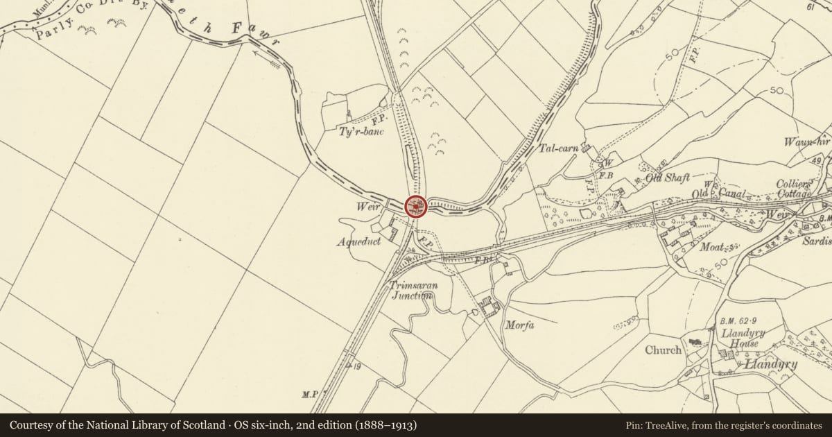
Former Kidwelly & Llanelly Canal aqueduct (also known as Glanstony Aqueduct)
Trimsaran, Carmarthenshire, Wales
A Grade II* listed building in Llandyry, Trimsaran, Carmarthenshire, designated on 23 July 2003.
The record
- Designation
- Listed building, Grade II*
- Broad class
- No class recorded
- Date of designation
- 23 July 2003
- Locality
- Llandyry
- Community
- Trimsaran
- Unitary authority
- Carmarthenshire
- Country
- Wales
- Coordinates
- 51.72431, -4.27800
- Cadw reference
- 81323
Slide toward Today to fade the historical sheet and see the modern map underneath.
David Rumsey Map Collection, Stanford LibrariesDavid Rumsey Map Collection, Stanford LibrariesDavid Rumsey Map Collection, Stanford LibrariesDavid Rumsey Map Collection, Stanford LibrariesDavid Rumsey Map Collection, Stanford Libraries
5 historical maps cover this location, the earliest the 1636 map "Cornubia : Devonia, Somersetus, Dorcestria, Wiltonia, Glocestria ..." (David Rumsey Map Collection, Stanford Libraries).
Historical maps covering this location
- 1636 · Cornubia : Devonia, Somersetus, Dorcestria, Wiltonia, Glocestria ... (David Rumsey Map Collection, Stanford Libraries)
- 1637 · The fourth table of England. Cornub. Devonia, Somerset etc. (David Rumsey Map Collection, Stanford Libraries)
- 1891 · Sheet 10. Ordnance Survey of England and Wales. . (David Rumsey Map Collection, Stanford Libraries)
- 1898 · 229 Carmarthen (Hills) (David Rumsey Map Collection, Stanford Libraries)
- 1920 · Sheet 100. Llanelly. (David Rumsey Map Collection, Stanford Libraries)
Cadw's description
Location
Spanning the Afon Gwendraeth Fawr NW of Morfa Mawr Farm, approximately 600m NW of Llandyry church.
History
The Kidwelly & Llanelli Canal was begun in 1812 and was built between Llanelli and Kymer''s Canal (1769) on the E side of Kidwelly. The engineer was James Pinkerton. The aqueduct is said to have been dated 1815. Later the canal was taken over by the Burry Port and Gwendraeth Valley Railway and in 1869 it built a railway mainly on the infilled bed of the old canal. The BP&GVR was taken over by the Great Western Railway in 1922. The line closed in 1965.
Exterior
A canal aqueduct built principally of coursed freestone, comprising 6 low segmental arches. On the E (upstream) side are V-shaped cutwaters with pyramidal caps. The R-hand (N) arch has partly fallen. The W side has overgrown (possibly square) cutwaters, and above the arches is mostly rebuilt in brick. The abutments are splayed on each bank.
Reason for designation
Listed grade II* as a fine early C19 canal aqueduct of national importance.
Scheduled Ancient Monument Cm 270 (CAM).
Nearby in the register
- Glanstony Aqueduct, TrimsaranAqueductunder 1 mi
- Bridge at Moat FarmTransportunder 1 mi
- Llandyry ChurchReligious, Ritual and Funeraryunder 1 mi
- Pont Spwdwr (Spudder's Bridge)Transportunder 1 mi
Other entries of the same register within about three miles of this one, by straight line.