Cof Cymru: National Historic Assets of Wales · Wales
Service building on N side of Cwmgwili
Bronwydd, Carmarthenshire, Wales
A Grade II listed building in Cwmgwili, Bronwydd, Carmarthenshire, designated on 22 July 2003.
The record
- Designation
- Listed building, Grade II
- Broad class
- No class recorded
- Date of designation
- 22 July 2003
- Locality
- Cwmgwili
- Community
- Bronwydd
- Unitary authority
- Carmarthenshire
- Country
- Wales
- Coordinates
- 51.88568, -4.29205
- Cadw reference
- 81310
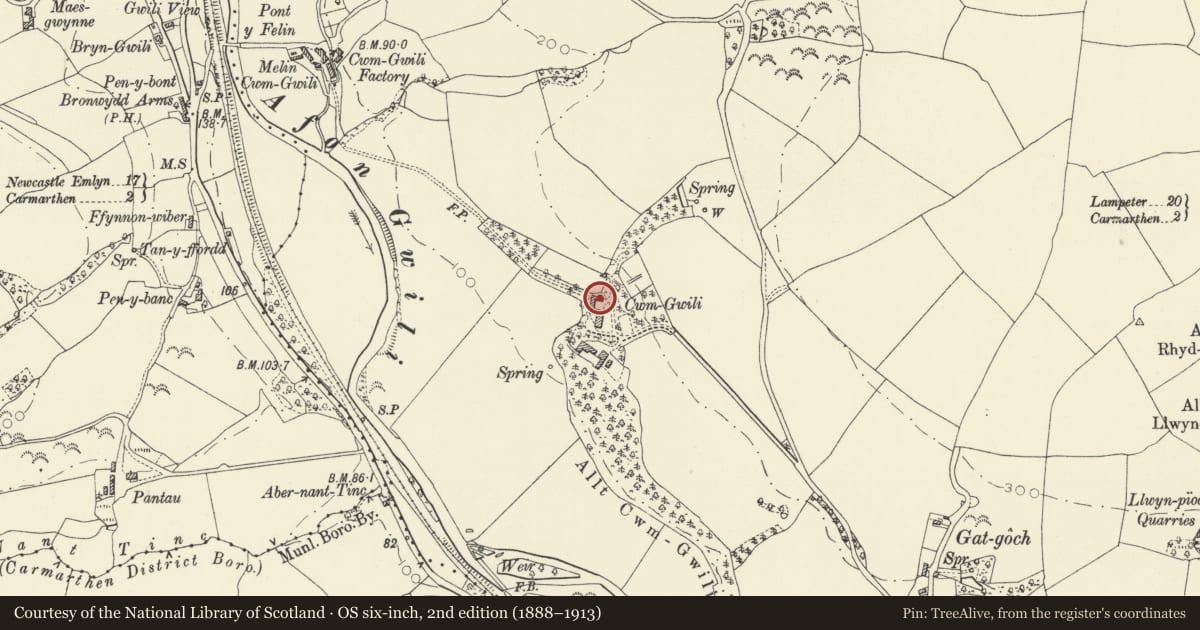
Slide toward Today to fade the historical sheet and see the modern map underneath.
David Rumsey Map Collection, Stanford LibrariesDavid Rumsey Map Collection, Stanford LibrariesDavid Rumsey Map Collection, Stanford LibrariesDavid Rumsey Map Collection, Stanford LibrariesDavid Rumsey Map Collection, Stanford Libraries
5 historical maps cover this location, the earliest the 1636 map "Cornubia : Devonia, Somersetus, Dorcestria, Wiltonia, Glocestria ..." (David Rumsey Map Collection, Stanford Libraries).
Historical maps covering this location
- 1636 · Cornubia : Devonia, Somersetus, Dorcestria, Wiltonia, Glocestria ... (David Rumsey Map Collection, Stanford Libraries)
- 1860 · 41. Caermathen. (David Rumsey Map Collection, Stanford Libraries)
- 1891 · Sheet 10. Ordnance Survey of England and Wales. . (David Rumsey Map Collection, Stanford Libraries)
- 1898 · 211 Newcastle Emlyn (Hills) (David Rumsey Map Collection, Stanford Libraries)
- 1901 · Sheet 14. (David Rumsey Map Collection, Stanford Libraries)
Cadw's description
Location
On the N side of the house.
Exterior
A 2-storey 2-window service building of rubble stone with slate roof and brick stack, renewed in the 1980s, to the R. Openings are offset L of centre. The central fielded-panel door is flanked by 2-light casements, with 16-pane horned sashes in the upper storey beneath the eaves. In the L gable end are 3 lines of pigeon holes with ledges, above a lean-to added c1950.
Interior
The present house at Cwmgwili was begun in the late C16, was extended in the early C18 and remodelled in the C19. The service building was built in the C19 in the courtyard on the N side of the house, and is shown on the 1889 Ordnance Survey. It was used as a laundry and as servants' accommodation.
Reason for designation
Listed as a service building retaining C19 character and detail, and for group value with the house.
Nearby in the register
- CwmgwiliDomesticunder 1 mi
- Milestone on A484 at former Bronwydd Arms public houseNo class recordedunder 1 mi
- House opposite Gardener's CottageNo class recordedunder 1 mi
- MilestoneTransportunder 1 mi
Other entries of the same register within about three miles of this one, by straight line.