Cof Cymru: National Historic Assets of Wales · Wales
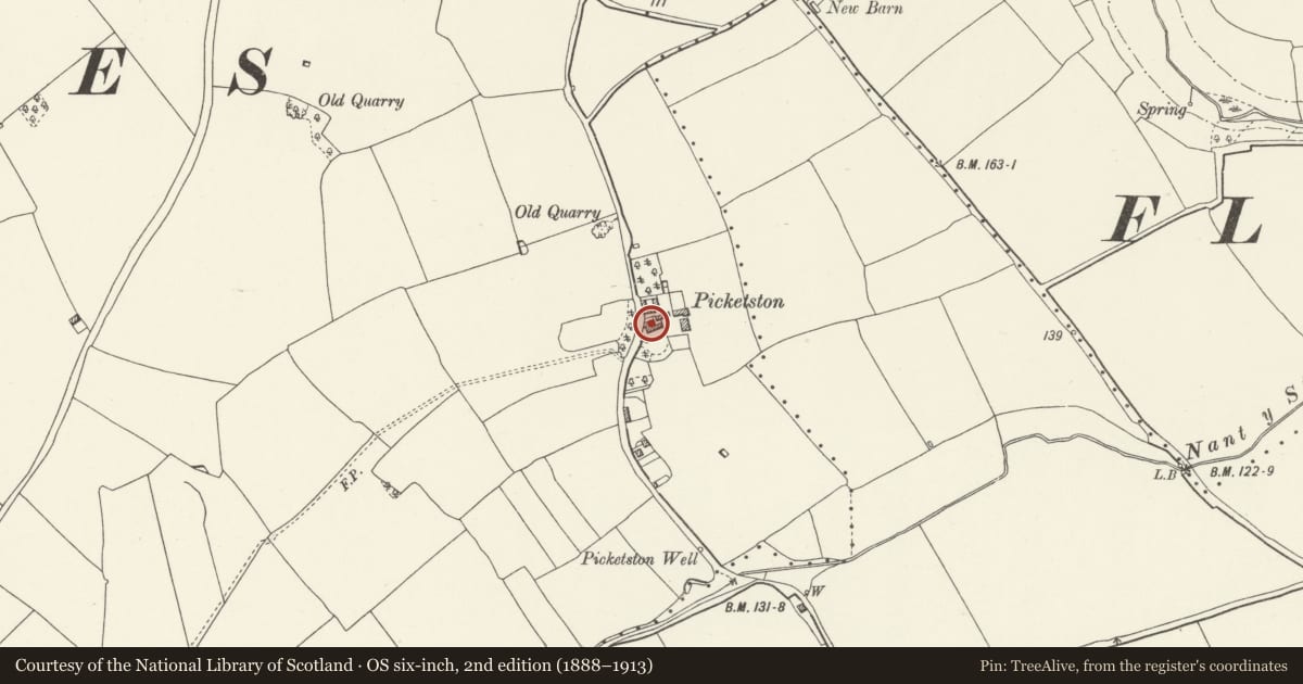
Picketston
Llan-Maes, Vale of Glamorgan, Wales
A Grade II listed building in Picketston, Barry, Llan-Maes, Vale of Glamorgan, designated on 21 July 2003.
The record
- Designation
- Listed building, Grade II
- Broad class
- Domestic
- Date of designation
- 21 July 2003
- Locality
- Picketston
- Town
- Barry
- Community
- Llan-Maes
- Unitary authority
- Vale of Glamorgan
- Country
- Wales
- Coordinates
- 51.41765, -3.43643
- Cadw reference
- 81302
Slide toward Today to fade the historical sheet and see the modern map underneath.
David Rumsey Map Collection, Stanford LibrariesDavid Rumsey Map Collection, Stanford LibrariesDavid Rumsey Map Collection, Stanford LibrariesDavid Rumsey Map Collection, Stanford LibrariesDavid Rumsey Map Collection, Stanford Libraries
5 historical maps cover this location, the earliest the 1636 map "Cornubia : Devonia, Somersetus, Dorcestria, Wiltonia, Glocestria ..." (David Rumsey Map Collection, Stanford Libraries).
Historical maps covering this location
- 1636 · Cornubia : Devonia, Somersetus, Dorcestria, Wiltonia, Glocestria ... (David Rumsey Map Collection, Stanford Libraries)
- 1637 · The fourth table of England. Cornub. Devonia, Somerset etc. (David Rumsey Map Collection, Stanford Libraries)
- 1865 · England and Wales. England No. 6. (David Rumsey Map Collection, Stanford Libraries)
- 1897 · 262 Pontypridd (Hills) (David Rumsey Map Collection, Stanford Libraries)
- 1897 · 262 Pontypridd (Outline) (David Rumsey Map Collection, Stanford Libraries)
Cadw's description
Location
On the eastern boundary of Llanmaes community closer to the village of St. Athan.
History
A Tudor Gothic style house characteristic of c1840. It is shown on the Tithe map of 1843.
Exterior
The building is roughcast, probably over local rubblestone and has Welsh slate roofs. Designed in an only slightly suggested Tudor Gothic style. One main range with a rear service wing. Two storeys, four windows, 8 over 8 pane sashes. The entrance is in the third bay from the left and has a projecting gabled porch with a modern replacement door in a 4-centred head, side windows to the porch. Above the porch the window is a standard 6 over 6 pane sash and above this is an eaves gable with a large moulded timber pendant. The roof is hipped with end stacks and a third in the centre on the rear wall, paired diamond set red brick shafts.
The rear elevation is plain, mostly with replacement plastic windows.
Interior
Interior not available for inspection at resurvey.
Reason for designation
Included as a c1840 house which retains its architectural character.
Nearby in the register
- Church of St BriseReligious, Ritual and Funeraryunder 1 mi
- Forecourt and Graveyard Gates, Gatepiers and Walls of Bethesda'r Fro ChapelNo class recordedunder 1 mi
- Bethesda'r Fro Chapel with attached mounting blockReligious, Ritual and Funeraryunder 1 mi
- Detached Kitchen at Flemingston CourtDomesticunder 1 mi
Other entries of the same register within about three miles of this one, by straight line.