Cof Cymru: National Historic Assets of Wales · Wales
Garden Wall of St. Cross
Llandaff, Cardiff, Wales
A Grade II listed building in Llandaff, Cardiff, designated on 19 May 1975.
The record
- Designation
- Listed building, Grade II
- Broad class
- Domestic
- Date of designation
- 19 May 1975
- Locality
- Llandaff
- Town
- Cardiff
- Community
- Llandaff
- Unitary authority
- Cardiff
- Country
- Wales
- Coordinates
- 51.49429, -3.21854
- Cadw reference
- 81268
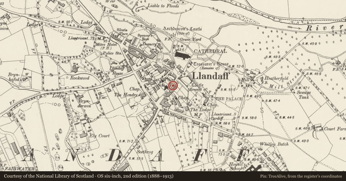
Slide toward Today to fade the historical sheet and see the modern map underneath.
David Rumsey Map Collection, Stanford LibrariesDavid Rumsey Map Collection, Stanford LibrariesDavid Rumsey Map Collection, Stanford LibrariesDavid Rumsey Map Collection, Stanford LibrariesDavid Rumsey Map Collection, Stanford Libraries
5 historical maps cover this location, the earliest the 1636 map "Cornubia : Devonia, Somersetus, Dorcestria, Wiltonia, Glocestria ..." (David Rumsey Map Collection, Stanford Libraries).
Historical maps covering this location
- 1636 · Cornubia : Devonia, Somersetus, Dorcestria, Wiltonia, Glocestria ... (David Rumsey Map Collection, Stanford Libraries)
- 1637 · The fourth table of England. Cornub. Devonia, Somerset etc. (David Rumsey Map Collection, Stanford Libraries)
- 1865 · England and Wales. England No. 6. (David Rumsey Map Collection, Stanford Libraries)
- 1898 · 263 Cardiff (Hills) (David Rumsey Map Collection, Stanford Libraries)
- 1913 · Sheet 110. Cardiff & Mouth of the Severn. (David Rumsey Map Collection, Stanford Libraries)
Cadw's description
Location
Running along the street frontage of St. Cross and part of the group of important buildings at the south-west entrance to The Cathedral Green.
History
c1861. Contemporary with St Andrew and St Cross Minor Canonries and part of the overall design by Ewan Christian.
Exterior
Wall to front garden of pale stone rubble with a sloping ashlar coping, interrupted by the gateway leading to the front door. The wall is about 20m in length and about 1.3m in height. The wall continues from the rear elevation of St. Andrews and then runs along the eastern boundary of lane (connecting High Street and Cardiff Road) as far as the garden wall to The Lodge.
Reason for designation
Included for its group value with the other listed buildings around The Cathedral Green and on the High Street.
Nearby in the register
- St. CrossDomesticunder 1 mi
- St. AndrewDomesticunder 1 mi
- Garden Wall of St. AndrewDomesticunder 1 mi
- 6 High StreetDomesticunder 1 mi
Other entries of the same register within about three miles of this one, by straight line.