Cof Cymru: National Historic Assets of Wales · Wales
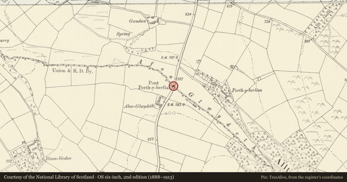
Perthyberllan bridge marker stone (partly in Llanfihangel ar Arth community)
Llanllwni, Carmarthenshire, Wales
A Grade II listed building in Perthyberllan, Llanllwni, Carmarthenshire, designated on 13 March 2003.
The record
- Designation
- Listed building, Grade II
- Broad class
- No class recorded
- Date of designation
- 13 March 2003
- Locality
- Perthyberllan
- Community
- Llanllwni
- Unitary authority
- Carmarthenshire
- Country
- Wales
- Coordinates
- 52.01496, -4.22217
- Cadw reference
- 81243
Slide toward Today to fade the historical sheet and see the modern map underneath.
David Rumsey Map Collection, Stanford LibrariesDavid Rumsey Map Collection, Stanford LibrariesDavid Rumsey Map Collection, Stanford LibrariesDavid Rumsey Map Collection, Stanford LibrariesDavid Rumsey Map Collection, Stanford Libraries
5 historical maps cover this location, the earliest the 1830 map "V.3:11-15:XV. Britisches Reich. A. Kon: England. b. Frstenthum Wales: Shire: 37-40" (David Rumsey Map Collection, Stanford Libraries).
Historical maps covering this location
- 1830 · V.3:11-15:XV. Britisches Reich. A. Kon: England. b. Frstenthum Wales: Shire: 37-40 (David Rumsey Map Collection, Stanford Libraries)
- 1860 · 41. Caermathen. (David Rumsey Map Collection, Stanford Libraries)
- 1891 · Sheet 10. Ordnance Survey of England and Wales. . (David Rumsey Map Collection, Stanford Libraries)
- 1898 · 211 Newcastle Emlyn (Hills) (David Rumsey Map Collection, Stanford Libraries)
- 1901 · Sheet 14. (David Rumsey Map Collection, Stanford Libraries)
Cadw's description
Location
Approximately 0.7km N of New Inn, on the parapet of a bridge to the W of Perthyberllan Farm.
History
Dated 1822.
Exterior
See Record Number 81003 for full description.
Reason for designation
Listed as an unusual C19 roadside monolith of distinctive character.
Nearby in the register
- Perthyberllan bridge marker stone (partly in Llanllwni Community)Transportunder 1 mi
- Old house at PerthyberllanNo class recordedunder 1 mi
- Animal house at PerthyberllanNo class recordedunder 1 mi
- Multi-purpose farm building at PerthyberllanNo class recordedunder 1 mi
Other entries of the same register within about three miles of this one, by straight line.