Cof Cymru: National Historic Assets of Wales · Wales
Canal Bridge No 47 on Monmouthshire and Brecon Canal
Panteg, Torfaen, Wales
A Grade II listed building in Sebastopol, Pontypool, Panteg, Torfaen, designated on 12 June 2003.
The record
- Designation
- Listed building, Grade II
- Broad class
- No class recorded
- Date of designation
- 12 June 2003
- Locality
- Sebastopol
- Town
- Pontypool
- Community
- Panteg
- Unitary authority
- Torfaen
- Country
- Wales
- Coordinates
- 51.67594, -3.02672
- Cadw reference
- 81178
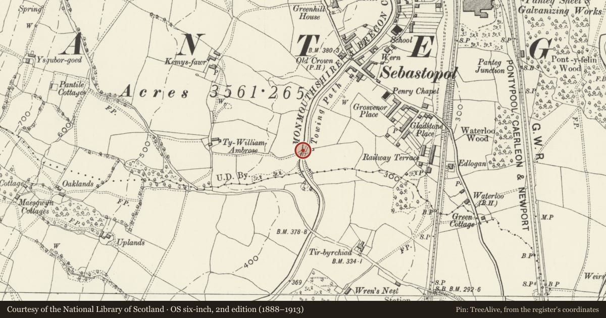
Slide toward Today to fade the historical sheet and see the modern map underneath.
David Rumsey Map Collection, Stanford LibrariesDavid Rumsey Map Collection, Stanford LibrariesDavid Rumsey Map Collection, Stanford LibrariesDavid Rumsey Map Collection, Stanford LibrariesDavid Rumsey Map Collection, Stanford Libraries
5 historical maps cover this location, the earliest the 1636 map "Cornubia : Devonia, Somersetus, Dorcestria, Wiltonia, Glocestria ..." (David Rumsey Map Collection, Stanford Libraries).
Historical maps covering this location
- 1636 · Cornubia : Devonia, Somersetus, Dorcestria, Wiltonia, Glocestria ... (David Rumsey Map Collection, Stanford Libraries)
- 1830 · V.3:11-15:XV.Britisches Reich. A. Kon: England. a. England ab sich: Shire:15-17, 33 (David Rumsey Map Collection, Stanford Libraries)
- 1895 · Sheet 11. Ordnance Survey of England and Wales. (David Rumsey Map Collection, Stanford Libraries)
- 1906 · 249 Newport (Hills) (David Rumsey Map Collection, Stanford Libraries)
- 1913 · Sheet 102. Newport. (David Rumsey Map Collection, Stanford Libraries)
Cadw's description
Location
Over the Monmouthshire and Brecon Canal just E of Elm Grove in Sebastopol.
History
Late C18 or early C19 canal bridge on the Monmouthshire Canal. Built by Thomas Dadford Junior 1792-9, the canal ran between Newport and Pontnewynydd, with a branch between Crindau and Crumlin.
Exterior
Hump-backed bridge, rubble sandstone with single elliptical arch with dressed stone voussoirs. Low
parapet with flat coping and abutments slightly splayed outwards ending in square piers. Tarmac deck. Repairs in concrete to coping and ends. Former tow path passed under bridge on E side. Cast iron plate on S side with ''''47'''' in raised white painted numbers.
Reason for designation
Listed as a late C18 canal bridge retaining its character.
Nearby in the register
- Ty William Ambrose Farm (aka Hanbury Farm)Agriculture and Subsistenceunder 1 mi
- Tir-brychiadNo class recordedunder 1 mi
- Barn on S side of Bevan's LaneNo class recordedunder 1 mi
- Milepost on Monmouthshire and Brecon CanalTransportunder 1 mi
Other entries of the same register within about three miles of this one, by straight line.