Cof Cymru: National Historic Assets of Wales · Wales
Cwt Gwyddau
Llanfair, Gwynedd, Wales
A Grade II listed building in Llanfair, Gwynedd, designated on 23 May 2003.
The record
- Designation
- Listed building, Grade II
- Broad class
- Agriculture and Subsistence
- Date of designation
- 23 May 2003
- Locality
- Llanfair
- Community
- Llanfair
- Unitary authority
- Gwynedd
- Country
- Wales
- Coordinates
- 52.84769, -4.07667
- Cadw reference
- 81087
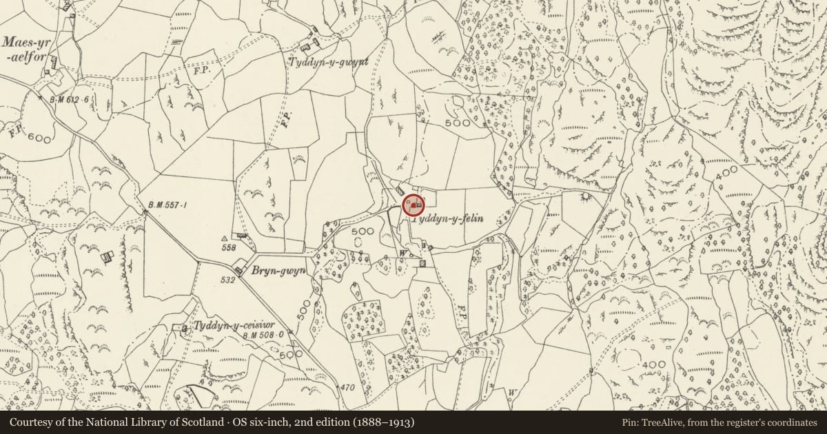
Slide toward Today to fade the historical sheet and see the modern map underneath.
David Rumsey Map Collection, Stanford LibrariesDavid Rumsey Map Collection, Stanford LibrariesDavid Rumsey Map Collection, Stanford LibrariesLlyfrgell Genedlaethol Cymru – The National Library of WalesDavid Rumsey Map Collection, Stanford Libraries
5 historical maps cover this location, the earliest the 1795 map "To Sir Watkin Williams-Wynn Bart ... the map of the six counties of North Wales is most humbly inscribed by his obedient humble servant" (Llyfrgell Genedlaethol Cymru – The National Library of Wales).
Historical maps covering this location
- 1795 · To Sir Watkin Williams-Wynn Bart ... the map of the six counties of North Wales is most… (Llyfrgell Genedlaethol Cymru – The National Library of Wales)
- 1883 · Watershed map England, Wales 3. (David Rumsey Map Collection, Stanford Libraries)
- 1896 · Sheet 7. Ordnance Survey of England and Wales. (David Rumsey Map Collection, Stanford Libraries)
- 1899 · 135 Harlech (Hills) (David Rumsey Map Collection, Stanford Libraries)
- 1901 · Sheet 9 and 10. (David Rumsey Map Collection, Stanford Libraries)
Cadw's description
Location
In a rural location, set well back from the NE side of a country road which leads SE from the Harlech crossroads along Fonllef Hir; c3km ENE of Llanfair. At the end of a track leading NE from Bryn Gwyn; the building is to SW of the house.
History
Date of construction unknown, but probably contemporary with the adjacent single-storey cottage at Tyddyn y Felin, possibly C17 or more probably C18.
Exterior
Set in the hillside at the SW corner of the single-storey cottage at Tyddyn y Felin and of similar construction, built of random rubble masonry with large stones as quoins and lintels. Slate roof with stone coping and tiled ridge. The building has widely spaced low doorways to each end of the N lateral wall and was probably used as a storehouse.
Interior
The interior of the building was not inspected at the time of the survey.
Reason for designation
Included as a integral part of the small farmstead unit at Tyddyn y Felin.
Nearby in the register
- Tyddyn-y-FelinDomesticunder 1 mi
- Drws yr Ymlid FarmhouseDomesticunder 1 mi
- Pigsty & Brewhouse at Drws yr Ymlid Farm (including rubble-walled yard between)Agriculture and Subsistenceunder 1 mi
- Barn at Drws yr Ymlid FarmAgriculture and Subsistenceunder 1 mi
Other entries of the same register within about three miles of this one, by straight line.