Cof Cymru: National Historic Assets of Wales · Wales
Gwalia
Llangynog, Powys, Wales
A Grade II listed building in Llangynog village, Llangynog, Powys, designated on 23 May 2003.
The record
- Designation
- Listed building, Grade II
- Broad class
- Domestic
- Date of designation
- 23 May 2003
- Locality
- Llangynog village
- Community
- Llangynog
- Unitary authority
- Powys
- Country
- Wales
- Coordinates
- 52.82431, -3.40766
- Cadw reference
- 81049
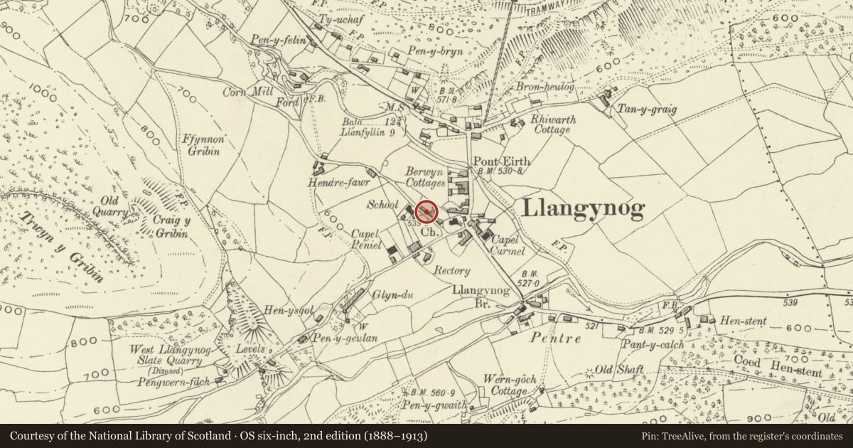
Slide toward Today to fade the historical sheet and see the modern map underneath.
David Rumsey Map Collection, Stanford LibrariesDavid Rumsey Map Collection, Stanford LibrariesLlyfrgell Genedlaethol Cymru – The National Library of WalesDavid Rumsey Map Collection, Stanford LibrariesDavid Rumsey Map Collection, Stanford Libraries
5 historical maps cover this location, the earliest the 1608 map "(13) Cambriae Typus." (David Rumsey Map Collection, Stanford Libraries).
Historical maps covering this location
- 1608 · (13) Cambriae Typus. (David Rumsey Map Collection, Stanford Libraries)
- 1795 · To Sir Watkin Williams-Wynn Bart ... the map of the six counties of North Wales is most… (Llyfrgell Genedlaethol Cymru – The National Library of Wales)
- 1883 · Watershed map England, Wales 3. (David Rumsey Map Collection, Stanford Libraries)
- 1899 · 136 Bala (Hills) (David Rumsey Map Collection, Stanford Libraries)
- 1901 · Sheet 9 and 10. (David Rumsey Map Collection, Stanford Libraries)
Cadw's description
Location
In School Terrace, Llangynog
History
Probably late C18, shown on the Tithe Map of 1839. The small attached former shop at the right probably added or adapted in the mid C19.
Exterior
A two-storey, three-window range within School Terrace comprising Gwalia and a small former corner shop to its right. The house is a two-unit composition with central door and the shop at right a single unit added to it or altered from a cottage. Rendered front elevation. Slate roof with tile ridge. Two chimneys in slate masonry. Cobbles at pavement edge.
The former shop at the right of the range has a small casement window above and an eight-pane straight shop window integral with the door opening.
The house stands on a high rendered plinth which rises to sill level but does not continue under the shop. The windows of the house at left and that in the return elevation at the right of the shop are four-pane sash windows without sills. Lightly constructed modern porch.
Reason for designation
A street group of house and village shop which has retained its quasi vernacular character.
Nearby in the register
- Church of St CynogReligious, Ritual and Funeraryunder 1 mi
- Llangynog BridgeTransportunder 1 mi
- Craig Rhiwarth Ancient VillageHillfortunder 1 mi
- Bryn GlasAgriculture and Subsistenceunder 1 mi
Other entries of the same register within about three miles of this one, by straight line.