Cof Cymru: National Historic Assets of Wales · Wales
Cruck range attached to Blaen-y-cwm farmhouse
Llangynog, Powys, Wales
A Grade II listed building in Cwm Pennant, Llangynog, Powys, designated on 23 May 2003.
The record
- Designation
- Listed building, Grade II
- Broad class
- Agriculture and Subsistence
- Date of designation
- 23 May 2003
- Locality
- Cwm Pennant
- Community
- Llangynog
- Unitary authority
- Powys
- Country
- Wales
- Coordinates
- 52.83124, -3.46009
- Cadw reference
- 81048
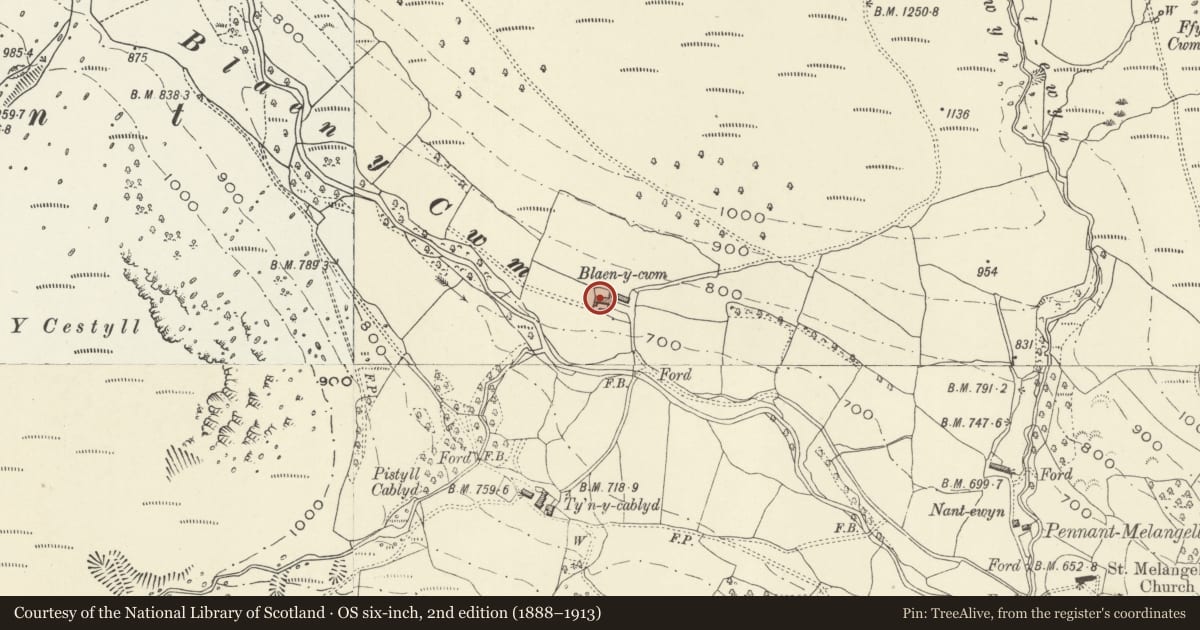
Slide toward Today to fade the historical sheet and see the modern map underneath.
David Rumsey Map Collection, Stanford LibrariesDavid Rumsey Map Collection, Stanford LibrariesLlyfrgell Genedlaethol Cymru – The National Library of WalesDavid Rumsey Map Collection, Stanford LibrariesDavid Rumsey Map Collection, Stanford Libraries
5 historical maps cover this location, the earliest the 1608 map "(13) Cambriae Typus." (David Rumsey Map Collection, Stanford Libraries).
Historical maps covering this location
- 1608 · (13) Cambriae Typus. (David Rumsey Map Collection, Stanford Libraries)
- 1795 · To Sir Watkin Williams-Wynn Bart ... the map of the six counties of North Wales is most… (Llyfrgell Genedlaethol Cymru – The National Library of Wales)
- 1883 · Watershed map England, Wales 3. (David Rumsey Map Collection, Stanford Libraries)
- 1899 · 136 Bala (Hills) (David Rumsey Map Collection, Stanford Libraries)
- 1901 · Sheet 9 and 10. (David Rumsey Map Collection, Stanford Libraries)
Cadw's description
Location
Attached to the west side of the projecting wing of Blaen-y-cwm farmhouse.
History
A C16/17 cruck range, possibly contemporary with or shortly after the early south-extending range of Blaen-y-cwm farmhouse. Its history appears to be that it was a cruck building, subsequently given stone external walls and a box-framed replacement truss, then re-roofed in small (C18?) slates. A tall gable relating to a former steeper roof pitch remains at the left end.
Exterior
A stone range of probably multi-purpose agricultural buildings in uncoursed quasi-rubble and with a slate roof. Two pigsties with monopitch roof form a low forward wing at the left, backing against the farmyard wall.
The main range has a small window at left overlooking the pigsties; adjacent boarded door; raised door over a stone landing with steps. At the right is another boarded door adjacent to the house. Three small rooflights have been inserted.
Interior
A five-bay interior, with one box-framed partition and three remaining cruck frames.
Reason for designation
A fine agricultural range with substantial cruck framing, listed also for group value with the farmhouse.
Nearby in the register
- Blaen-y-CwmDomesticunder 1 mi
- Agricultural range east of Blaen-y-cwm farmhouseAgriculture and Subsistenceunder 1 mi
- Tyn-y-CablydDomesticunder 1 mi
- Old Nant-ewyn cottage with pigsties and privyAgriculture and Subsistenceunder 1 mi
Other entries of the same register within about three miles of this one, by straight line.