Cof Cymru: National Historic Assets of Wales · Wales
Red Lion
Llanegwad, Carmarthenshire, Wales
A Grade II listed building in Llanegwad, Carmarthenshire, designated on 1 April 2003.
The record
- Designation
- Listed building, Grade II
- Broad class
- Domestic
- Date of designation
- 1 April 2003
- Locality
- Llanegwad
- Community
- Llanegwad
- Unitary authority
- Carmarthenshire
- Country
- Wales
- Coordinates
- 51.87162, -4.15176
- Cadw reference
- 81016
Slide toward Today to fade the historical sheet and see the modern map underneath.
David Rumsey Map Collection, Stanford LibrariesDavid Rumsey Map Collection, Stanford LibrariesDavid Rumsey Map Collection, Stanford LibrariesDavid Rumsey Map Collection, Stanford LibrariesDavid Rumsey Map Collection, Stanford Libraries
5 historical maps cover this location, the earliest the 1636 map "Cornubia : Devonia, Somersetus, Dorcestria, Wiltonia, Glocestria ..." (David Rumsey Map Collection, Stanford Libraries).
Historical maps covering this location
- 1636 · Cornubia : Devonia, Somersetus, Dorcestria, Wiltonia, Glocestria ... (David Rumsey Map Collection, Stanford Libraries)
- 1830 · V.3:11-15:XV. Britisches Reich. A. Kon: England. b. Frstenthum Wales: Shire: 37-40 (David Rumsey Map Collection, Stanford Libraries)
- 1860 · 41. Caermathen. (David Rumsey Map Collection, Stanford Libraries)
- 1891 · Sheet 10. Ordnance Survey of England and Wales. . (David Rumsey Map Collection, Stanford Libraries)
- 1901 · Sheet 14. (David Rumsey Map Collection, Stanford Libraries)
Cadw's description
Location
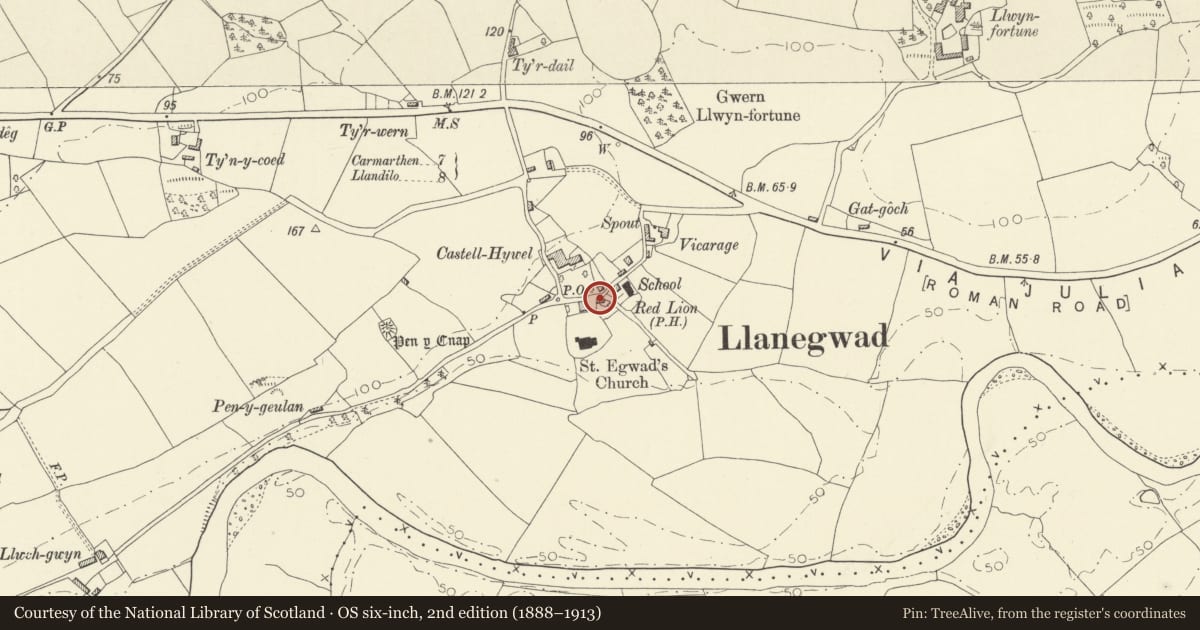
On the N side of the churchyard, and the S side of the main road through the village.
History
Shown on the 1839 Tithe map as the Red Lion Inn, when it incorporated a malthouse. The present building is probably a rebuilding of the mid C19 and originally had a rear wing, shown on the 1888 Ordnance Survey.
Exterior
A 2-storey 3-window former public house of rubble stone with bigger quoins, and slate roof with end stone stacks. Openings are offset to the L and are unequally placed. A central gabled canopy has diamond-pattern slates above a panelled door with plain overlight. Windows are 12-pane hornless sashes with stone lintels. The roughcast L gable end has a lower added garage in line. In the R gable end, facing the entrance to the churchyard, is an 8-pane sash window lower L and a pantry window lower R retaining original mesh. The rear has an added raked dormer incorporating 3 2-light small-pane casements.
Interior
Not inspected.
Reason for designation
Listed as a well-detailed C19 former public house contributing to the overall historic character of the village.
Nearby in the register
- Mounting block at N entrance to Llanegwad churchyardTransportunder 1 mi
- Ty LlandreDomesticunder 1 mi
- Church of St EgwadReligious, Ritual and Funeraryunder 1 mi
- Stables and coach house at TawelfanDomesticunder 1 mi
Other entries of the same register within about three miles of this one, by straight line.