Cof Cymru: National Historic Assets of Wales · Wales
Detached farm range at Cefn Pentre
Meifod, Powys, Wales
A Grade II listed building in Meifod, Powys, designated on 31 March 2003.
The record
- Designation
- Listed building, Grade II
- Broad class
- Agriculture and Subsistence
- Date of designation
- 31 March 2003
- Locality
- Meifod
- Community
- Meifod
- Unitary authority
- Powys
- Country
- Wales
- Coordinates
- 52.69253, -3.23095
- Cadw reference
- 81010
Slide toward Today to fade the historical sheet and see the modern map underneath.
David Rumsey Map Collection, Stanford LibrariesDavid Rumsey Map Collection, Stanford LibrariesDavid Rumsey Map Collection, Stanford LibrariesDavid Rumsey Map Collection, Stanford LibrariesLlyfrgell Genedlaethol Cymru – The National Library of Wales
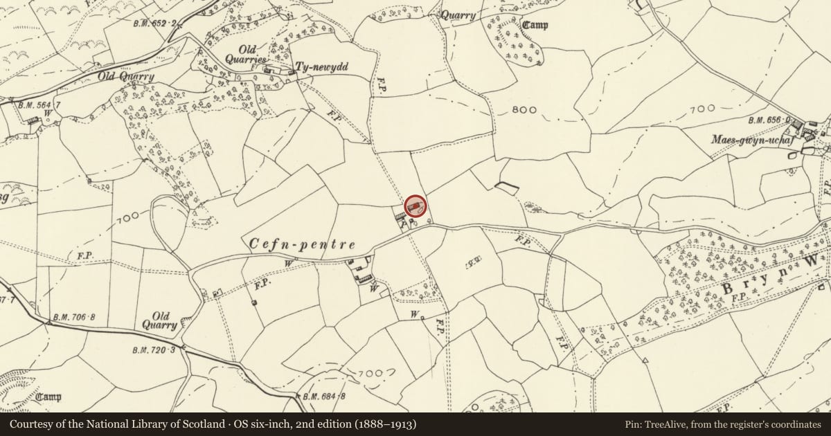
5 historical maps cover this location, the earliest the 1795 map "To Sir Watkin Williams-Wynn Bart ... the map of the six counties of North Wales is most humbly inscribed by his obedient humble servant" (Llyfrgell Genedlaethol Cymru – The National Library of Wales).
Historical maps covering this location
- 1795 · To Sir Watkin Williams-Wynn Bart ... the map of the six counties of North Wales is most… (Llyfrgell Genedlaethol Cymru – The National Library of Wales)
- 1883 · Watershed map England, Wales 3. (David Rumsey Map Collection, Stanford Libraries)
- 1899 · 151 Welshpool (Hills) (David Rumsey Map Collection, Stanford Libraries)
- 1901 · Sheet 9 and 10. (David Rumsey Map Collection, Stanford Libraries)
- 1916 · Sheet 60. Shrewsbury. (David Rumsey Map Collection, Stanford Libraries)
Cadw's description
Location
Parallel to the main range, set back to its right.
History
No secure dating evidence, but likely to be a seventeenth or early eighteenth century addition to the farmstead, apparently as additional lofted stock accommodation.
Exterior
Timber framed on a stone plinth with weather boarded cladding and corrugated tin roof. End bay added or rebuilt in brick. Existing openings comprise dooways at left-hand gable end, and towards right-hand end, both with plank doors; inserted windows adjacent to left-hand doorway, a shuttered loft window towards each end and a taller loft opening towards the centre. Lower extension at left hand end.
Interior
Interior not seen.
Reason for designation
Listed as a tradition lofted farm-building, its original structure substantially intact, which forms a group with the main range at Cefn Pentre.
Nearby in the register
- Cefn PentreAgriculture and Subsistenceunder 1 mi
- Camp 135m SE of Pant MawrEnclosureunder 1 mi
- Bwlch Aeddan DykeLinear Earthworkunder 1 mi
- Clawdd Wood round barrowRound Barrowunder 1 mi
Other entries of the same register within about three miles of this one, by straight line.