Cof Cymru: National Historic Assets of Wales · Wales
Ty Poeth Cottage
Llanfihangel-ar-Arth, Carmarthenshire, Wales
A Grade II listed building in Pont-Tyweli, Llanfihangel-ar-Arth, Carmarthenshire, designated on 13 March 2003.
The record
- Designation
- Listed building, Grade II
- Broad class
- Domestic
- Date of designation
- 13 March 2003
- Locality
- Pont-Tyweli
- Community
- Llanfihangel-ar-Arth
- Unitary authority
- Carmarthenshire
- Country
- Wales
- Coordinates
- 52.02623, -4.30203
- Cadw reference
- 81007
Slide toward Today to fade the historical sheet and see the modern map underneath.
David Rumsey Map Collection, Stanford LibrariesDavid Rumsey Map Collection, Stanford LibrariesDavid Rumsey Map Collection, Stanford LibrariesDavid Rumsey Map Collection, Stanford LibrariesDavid Rumsey Map Collection, Stanford Libraries
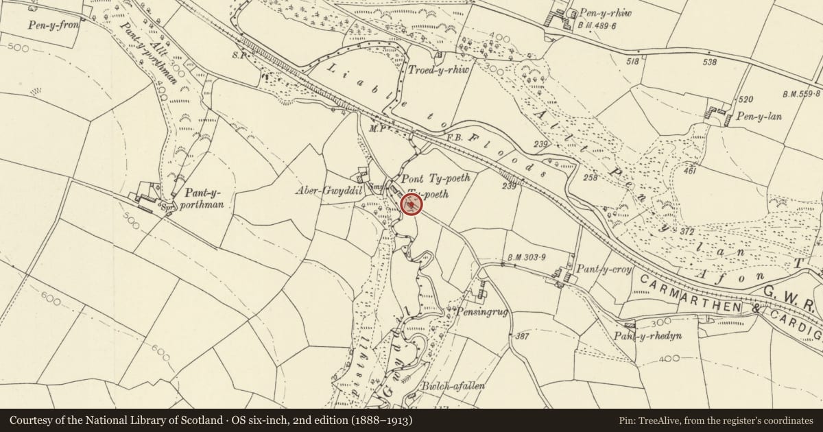
5 historical maps cover this location, the earliest the 1830 map "V.3:11-15:XV. Britisches Reich. A. Kon: England. b. Frstenthum Wales: Shire: 37-40" (David Rumsey Map Collection, Stanford Libraries).
Historical maps covering this location
- 1830 · V.3:11-15:XV. Britisches Reich. A. Kon: England. b. Frstenthum Wales: Shire: 37-40 (David Rumsey Map Collection, Stanford Libraries)
- 1860 · 41. Caermathen. (David Rumsey Map Collection, Stanford Libraries)
- 1891 · Sheet 10. Ordnance Survey of England and Wales. . (David Rumsey Map Collection, Stanford Libraries)
- 1898 · 211 Newcastle Emlyn (Hills) (David Rumsey Map Collection, Stanford Libraries)
- 1901 · Sheet 14. (David Rumsey Map Collection, Stanford Libraries)
Cadw's description
Location
Approximately 1.4km SE of Pont-Tyweli village, on the S side of a minor road and E of Pont Ty-poeth.
History
Built in the mid C19 and first shown on the 1889 Ordnance Survey.
Exterior
A single-storey 2-window cottage of whitened rubble stone and renewed slate roof with stone stack to the R. Openings are offset to the R. A boarded door is in a rendered architrave. It has a 4-pane horned sash window to its R under a wooden lintel and a larger 2-pane margin-lit sash window to its L. It has an added lean-to to the L and lower projection in-line to the R.
Interior
Not inspected.
Reason for designation
Listed as a well-preserved C19 labourer''''''''s cottage of a type once common in the district.
Nearby in the register
- Castle Llwyn BedwMotteunder 1 mi
- Pont Llandysul (Partly in Llandysul Community)Transportunder 1 mi
- Llandysul Bridge (partly in Llanfihangel-ar Arth community, Carmarthenshire)Transportunder 1 mi
- Bridge StreetDomesticunder 1 mi
Other entries of the same register within about three miles of this one, by straight line.