Cof Cymru: National Historic Assets of Wales · Wales
New Bridge
Llanwddyn, Powys, Wales
A Grade II listed building in Lake Vyrnwy, Llanwddyn, Powys, designated on 26 February 2003.
The record
- Designation
- Listed building, Grade II
- Broad class
- Transport
- Date of designation
- 26 February 2003
- Locality
- Lake Vyrnwy
- Community
- Llanwddyn
- Unitary authority
- Powys
- Country
- Wales
- Coordinates
- 52.80504, -3.53803
- Cadw reference
- 80921
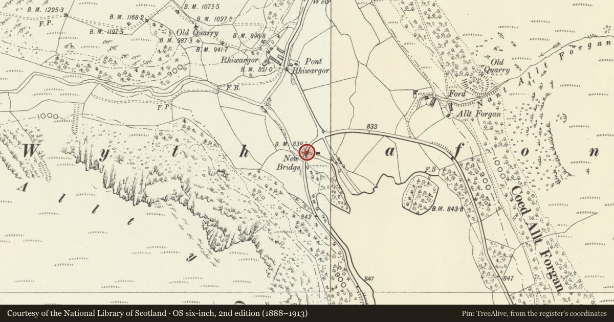
Slide toward Today to fade the historical sheet and see the modern map underneath.
David Rumsey Map Collection, Stanford LibrariesDavid Rumsey Map Collection, Stanford LibrariesLlyfrgell Genedlaethol Cymru – The National Library of WalesDavid Rumsey Map Collection, Stanford LibrariesDavid Rumsey Map Collection, Stanford Libraries
5 historical maps cover this location, the earliest the 1795 map "To Sir Watkin Williams-Wynn Bart ... the map of the six counties of North Wales is most humbly inscribed by his obedient humble servant" (Llyfrgell Genedlaethol Cymru – The National Library of Wales).
Historical maps covering this location
- 1795 · To Sir Watkin Williams-Wynn Bart ... the map of the six counties of North Wales is most… (Llyfrgell Genedlaethol Cymru – The National Library of Wales)
- 1830 · V.3:11-15:XV. Britisches Reich. A. Kon: England. b. Frstenthum Wales: Shire: 37-40 (David Rumsey Map Collection, Stanford Libraries)
- 1883 · Watershed map England, Wales 3. (David Rumsey Map Collection, Stanford Libraries)
- 1899 · 136 Bala (Hills) (David Rumsey Map Collection, Stanford Libraries)
- 1901 · Sheet 9 and 10. (David Rumsey Map Collection, Stanford Libraries)
Cadw's description
Location
On the south lakeside road 9.0 km from the Vyrnwy Dam.
History
This bridge is marked on the Ordnance Survey map of 1887, and may be the first of the series of bridges of various designs constituting a set on the 17-km Lake Vyrnwy perimeter road.
Exterior
A low bridge of three spans of segmental form, in rock-faced masonry with voussoirs about 500 mm high. The keystones are not differentiated. Each span is about 5 m.
The carriageway is about 6 m wide between the handrails; these consist of steel or iron rails on cast-iron standards on stone plinths, terminating with rusticated ashlar piers and copings. The cast-iron standards are of square section with ball-finials, chamfers and enlarged feet.
Reason for designation
One of a set of bridges, in various monumental styles and evidently designed by different hands, related to the exploitation of the Reservoir perimeter road for its touristic potential, and closely related to the management of the Reservoir estate.
Nearby in the register
- Pont RhiwargorTransportunder 1 mi
- Pont EunantTransport1 mi
- Creigiau'r Llyn cairn cemeteryRound Cairn2 mi
- Cwm-yr-hafod BridgeTransport2 mi
Other entries of the same register within about three miles of this one, by straight line.