Cof Cymru: National Historic Assets of Wales · Wales
Pontygwaith Overbridge
Treharris, Merthyr Tydfil, Wales
A Grade II listed building in Pontygwaith, Merthyr Tydfil, Treharris, designated on 20 February 2003.
The record
- Designation
- Listed building, Grade II
- Broad class
- No class recorded
- Date of designation
- 20 February 2003
- Date of amendment
- 5 April 2016
- Locality
- Pontygwaith
- Town
- Merthyr Tydfil
- Community
- Treharris
- Unitary authority
- Merthyr Tydfil
- Country
- Wales
- Coordinates
- 51.67104, -3.33045
- Cadw reference
- 80908
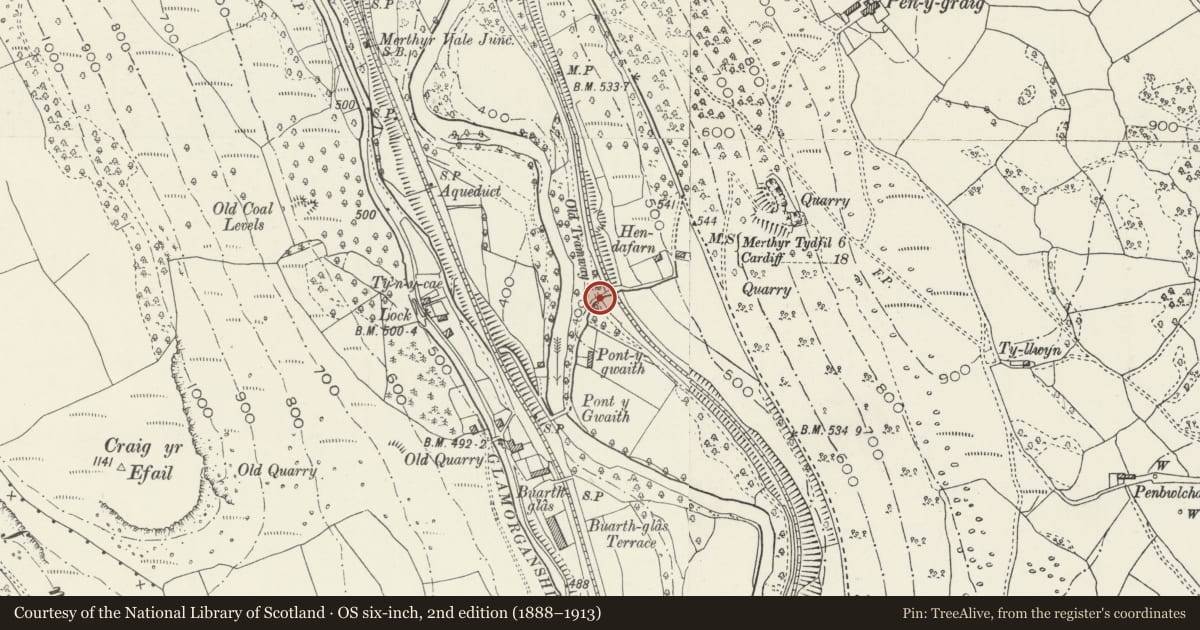
Slide toward Today to fade the historical sheet and see the modern map underneath.
David Rumsey Map Collection, Stanford LibrariesNational Library of ScotlandDavid Rumsey Map Collection, Stanford LibrariesDavid Rumsey Map Collection, Stanford LibrariesDavid Rumsey Map Collection, Stanford Libraries
5 historical maps cover this location, the earliest the 1636 map "Cornubia : Devonia, Somersetus, Dorcestria, Wiltonia, Glocestria ..." (David Rumsey Map Collection, Stanford Libraries).
Historical maps covering this location
- 1636 · Cornubia : Devonia, Somersetus, Dorcestria, Wiltonia, Glocestria ... (David Rumsey Map Collection, Stanford Libraries)
- 1637 · The fourth table of England. Cornub. Devonia, Somerset etc. (David Rumsey Map Collection, Stanford Libraries)
- 1865 · England and Wales. England No. 6. (David Rumsey Map Collection, Stanford Libraries)
- 1895 · Sheet 11. Ordnance Survey of England and Wales. (David Rumsey Map Collection, Stanford Libraries)
- 1963 · Map No. 13 - Local Government Commission for Wales : [Definitive maps showing proposed… (National Library of Scotland)
Cadw's description
Location
Reached down a steep by-road from the old Cardiff to Merthyr road; by-road crosses the former Taff Vale Railway just before the overbridge.
History
Overbridge carrying the track to Pont y Gwaith over the Penydarren tramroad, said to be mid C19 as crossing a diversion on the tramroad. The bridge immediately adjoins the bridge over the Taff Vale railway opened in 1841 and may have been rebuilt to accommodate the altered roadway. Restored as part of the Trevithick 2004 Project.
Exterior
Road bridge over former tramroad, abutting railway bridge. Rubble stone, tall narrow arch with stone voussoirs and rubble stone, the parapets sloping up with roadway to abut railway bridge parapets.
Reason for designation
Included for its special interest as a stone overbridge over the Penydarren tramroad, a nationally important feature in the history of iron production and railway development in Wales. Group value with the adjacent railway bridge.
Nearby in the register
- Pontygwaith Rail OverbridgeTransportunder 1 mi
- Pont y GwaithTransportunder 1 mi
- Merthyr Tramroad: Pont y Gwaith section and associated bridgesTramroadunder 1 mi
- Quakers Yard Railway ViaductTransportunder 1 mi
Other entries of the same register within about three miles of this one, by straight line.