Cof Cymru: National Historic Assets of Wales · Wales
Field Barn to North of Er Wallo
Glyntraian, Wrexham, Wales
A Grade II listed building in Er Wallo, Glyntraian, Wrexham, designated on 18 February 2003.
The record
- Designation
- Listed building, Grade II
- Broad class
- Agriculture and Subsistence
- Date of designation
- 18 February 2003
- Locality
- Er Wallo
- Community
- Glyntraian
- Unitary authority
- Wrexham
- Country
- Wales
- Coordinates
- 52.93556, -3.16469
- Cadw reference
- 80888
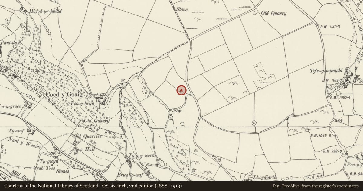
Slide toward Today to fade the historical sheet and see the modern map underneath.
David Rumsey Map Collection, Stanford LibrariesDavid Rumsey Map Collection, Stanford LibrariesDavid Rumsey Map Collection, Stanford LibrariesLlyfrgell Genedlaethol Cymru – The National Library of WalesDavid Rumsey Map Collection, Stanford Libraries
5 historical maps cover this location, the earliest the 1608 map "(13) Cambriae Typus." (David Rumsey Map Collection, Stanford Libraries).
Historical maps covering this location
- 1608 · (13) Cambriae Typus. (David Rumsey Map Collection, Stanford Libraries)
- 1795 · To Sir Watkin Williams-Wynn Bart ... the map of the six counties of North Wales is most… (Llyfrgell Genedlaethol Cymru – The National Library of Wales)
- 1883 · Watershed map England, Wales 3. (David Rumsey Map Collection, Stanford Libraries)
- 1898 · 121 Wrexham (Hills) (David Rumsey Map Collection, Stanford Libraries)
- 1901 · Sheet 9 and 10. (David Rumsey Map Collection, Stanford Libraries)
Cadw's description
Location
Located off the W side of a lane which runs steeply N from Er Wallo, on the N side of the Ceiriog Valley.
History
C16-17 cruck-framed barn, which could have been a house originally (?), later infilled with rubble stone. A range built in front of the S end is not shown on the Ordnance Survey of 1880.
Exterior
Barn of rubble stone, incorporating at least one cruck-truss, under a corrugated iron roof. Probably of 3 bays. The entrance faces E; wide doorway to L of centre rising to eaves, and further doorway to far L. The N gable end is cruck-framed: the crucks appear to reach the ground, their apex obscured by vertical timber boarding to the gable, which contains a loft hatch opening. Rubble stone infill between crucks, possibly with a plinth. Rear (W) side not visible. A second, later, range, in poor condition, has been built in front of the S gable end.
Interior
No access to interior at time of inspection.
Reason for designation
Listed as a field barn with a fine cruck-truss, a rare survival of this vernacular building type.
Nearby in the register
- Pen-y-Brongyll Round BarrowRound Barrowunder 1 mi
- Talygarth Isaf FarmDomesticunder 1 mi
- Milestone at DolywernTransportunder 1 mi
- Former Waiting Room, Glyn Valley Tramway, DolywernTransportunder 1 mi
Other entries of the same register within about three miles of this one, by straight line.