Cof Cymru: National Historic Assets of Wales · Wales
St Cadfan's Well
Banwy, Powys, Wales
A Grade II listed building in Llangadfan, Banwy, Powys, designated on 31 December 2002.
The record
- Designation
- Listed building, Grade II
- Broad class
- No class recorded
- Date of designation
- 31 December 2002
- Locality
- Llangadfan
- Community
- Banwy
- Unitary authority
- Powys
- Country
- Wales
- Coordinates
- 52.68261, -3.46436
- Cadw reference
- 80804
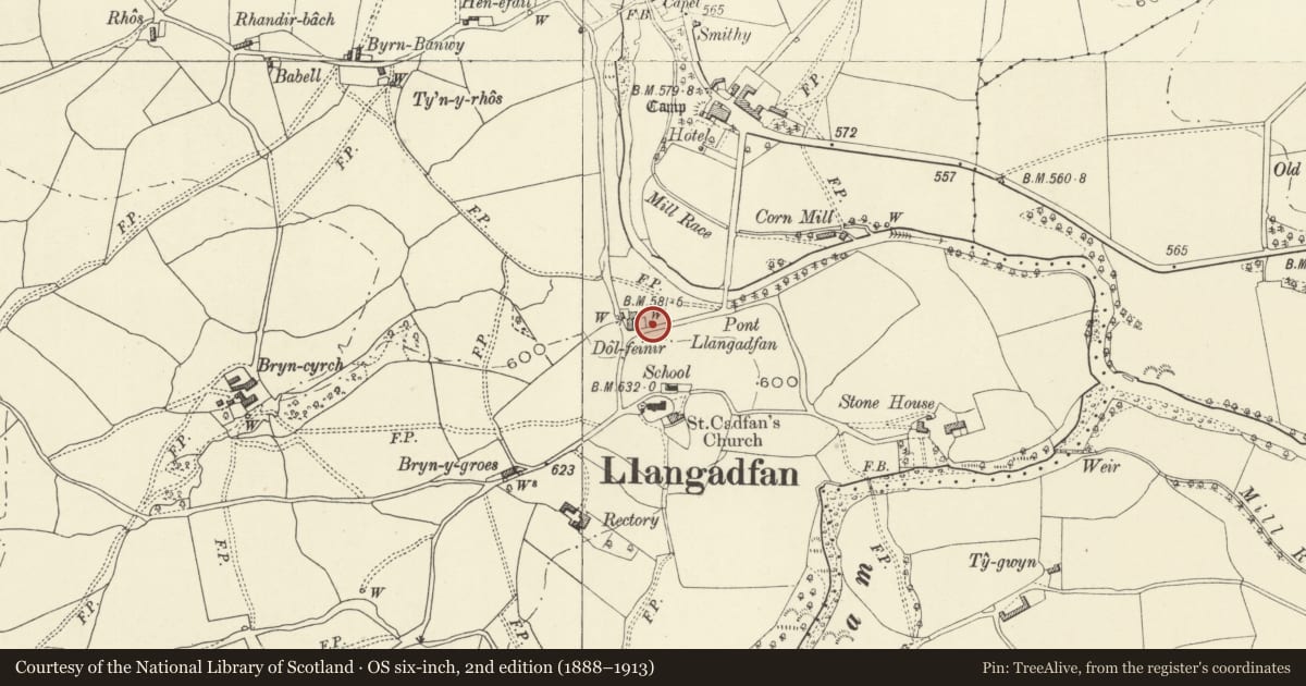
Slide toward Today to fade the historical sheet and see the modern map underneath.
David Rumsey Map Collection, Stanford LibrariesDavid Rumsey Map Collection, Stanford LibrariesLlyfrgell Genedlaethol Cymru – The National Library of WalesDavid Rumsey Map Collection, Stanford LibrariesDavid Rumsey Map Collection, Stanford Libraries
5 historical maps cover this location, the earliest the 1608 map "(13) Cambriae Typus." (David Rumsey Map Collection, Stanford Libraries).
Historical maps covering this location
- 1608 · (13) Cambriae Typus. (David Rumsey Map Collection, Stanford Libraries)
- 1795 · To Sir Watkin Williams-Wynn Bart ... the map of the six counties of North Wales is most… (Llyfrgell Genedlaethol Cymru – The National Library of Wales)
- 1883 · Watershed map England, Wales 3. (David Rumsey Map Collection, Stanford Libraries)
- 1899 · 150 Dinas-Mawddwy (Hills) (David Rumsey Map Collection, Stanford Libraries)
- 1901 · Sheet 9 and 10. (David Rumsey Map Collection, Stanford Libraries)
Cadw's description
Location
At north side of the road 100m west of Pont Llangadfan (reached by a small path connecting Dol-feinir and Bryn-hyfryd).
History
St Cadfan''s well is a spring of indefinite antiquity with a reputation for cures, and is mentioned in the Cambrian Register, 1796, as covered by a building, but this has not survived. When the adjacent road was
constructed as part of the work associated with Pont Llangadfan in c.1845 the rector, the Rev. Griffith
Howell, insisted on an arch being constructed to protect the well. It has been used within living memory
and the water is regarded as particularly pure.
Exterior
A small rectangular three-sided structure of local roughly dressed stone, enclosing a shallow pool. The
opening at front is a little over 1 m high, and there are steps down to the water. The top is slabbed over.
Reason for designation
An ancient holy well in good state of preservation, its history documented.
Nearby in the register
- Pont LlangadfanNo class recordedunder 1 mi
- Church of St CadfanReligious, Ritual and Funeraryunder 1 mi
- Lychgate of St Cadfan's ChurchNo class recordedunder 1 mi
- Detached Outbuildings Range at Rhiwlas (former Rectory)No class recordedunder 1 mi
Other entries of the same register within about three miles of this one, by straight line.