Cof Cymru: National Historic Assets of Wales · Wales
Pont-y-clochydd
Banwy, Powys, Wales
A Grade II listed building in Foel, Banwy, Powys, designated on 31 December 2002.
The record
- Designation
- Listed building, Grade II
- Broad class
- No class recorded
- Date of designation
- 31 December 2002
- Locality
- Foel
- Community
- Banwy
- Unitary authority
- Powys
- Country
- Wales
- Coordinates
- 52.69616, -3.49453
- Cadw reference
- 80801
Slide toward Today to fade the historical sheet and see the modern map underneath.
David Rumsey Map Collection, Stanford LibrariesDavid Rumsey Map Collection, Stanford LibrariesLlyfrgell Genedlaethol Cymru – The National Library of WalesDavid Rumsey Map Collection, Stanford LibrariesDavid Rumsey Map Collection, Stanford Libraries
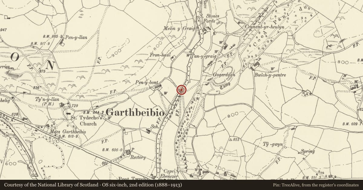
5 historical maps cover this location, the earliest the 1608 map "(13) Cambriae Typus." (David Rumsey Map Collection, Stanford Libraries).
Historical maps covering this location
- 1608 · (13) Cambriae Typus. (David Rumsey Map Collection, Stanford Libraries)
- 1795 · To Sir Watkin Williams-Wynn Bart ... the map of the six counties of North Wales is most… (Llyfrgell Genedlaethol Cymru – The National Library of Wales)
- 1883 · Watershed map England, Wales 3. (David Rumsey Map Collection, Stanford Libraries)
- 1899 · 150 Dinas-Mawddwy (Hills) (David Rumsey Map Collection, Stanford Libraries)
- 1901 · Sheet 9 and 10. (David Rumsey Map Collection, Stanford Libraries)
Cadw's description
Location
Over the Afon Twrch about 500m upstream from Pont Twrch.
History
A mediaeval bridge which came to be called pont-y-clochydd because of the proximity of the house of the
sextant (Pen-y-bont).
A short abandoned hollow lane leads down to the bridge from the road on the west side. As an early
crossing of the Twrch the bridge is reputed to have been used in the early C15 by Owain Glyndwr
passing from Machynlleth to Sycharth and in 1485 by Henry Tudor on his way to Bosworth.
Exterior
A single arch bridge in quasi-rubble slate masonry, with a segmental span of about 8 m, built about 5 m
above the Afon Twrch. The voussoirs are not of regularised height and the common masonry is uncoursed.
The bridge carries a cobbled roadway about 2½ m wide between uncoped and uncoursed parapets less
than 1 m high.
Reason for designation
A remarkable survival of a simple vernacular bridge of considerable antiquity in unaltered condition
including its cobbled paving.
Nearby in the register
- Gogerddan CampHillfortunder 1 mi
- Lletypiod and TynewyddNo class recordedunder 1 mi
- Parish Church of St Tydecho, FoelReligious, Ritual and Funeraryunder 1 mi
- Ty'n-y-llanNo class recordedunder 1 mi
Other entries of the same register within about three miles of this one, by straight line.