Cof Cymru: National Historic Assets of Wales · Wales
Farm Range to W of Faenol-bach Farmyard
Bodelwyddan, Denbighshire, Wales
A Grade II listed building in Faenol-bach, Bodelwyddan, Denbighshire, designated on 7 March 1975.
The record
- Designation
- Listed building, Grade II
- Broad class
- No class recorded
- Date of designation
- 7 March 1975
- Locality
- Faenol-bach
- Community
- Bodelwyddan
- Unitary authority
- Denbighshire
- Country
- Wales
- Coordinates
- 53.27383, -3.51932
- Cadw reference
- 80744
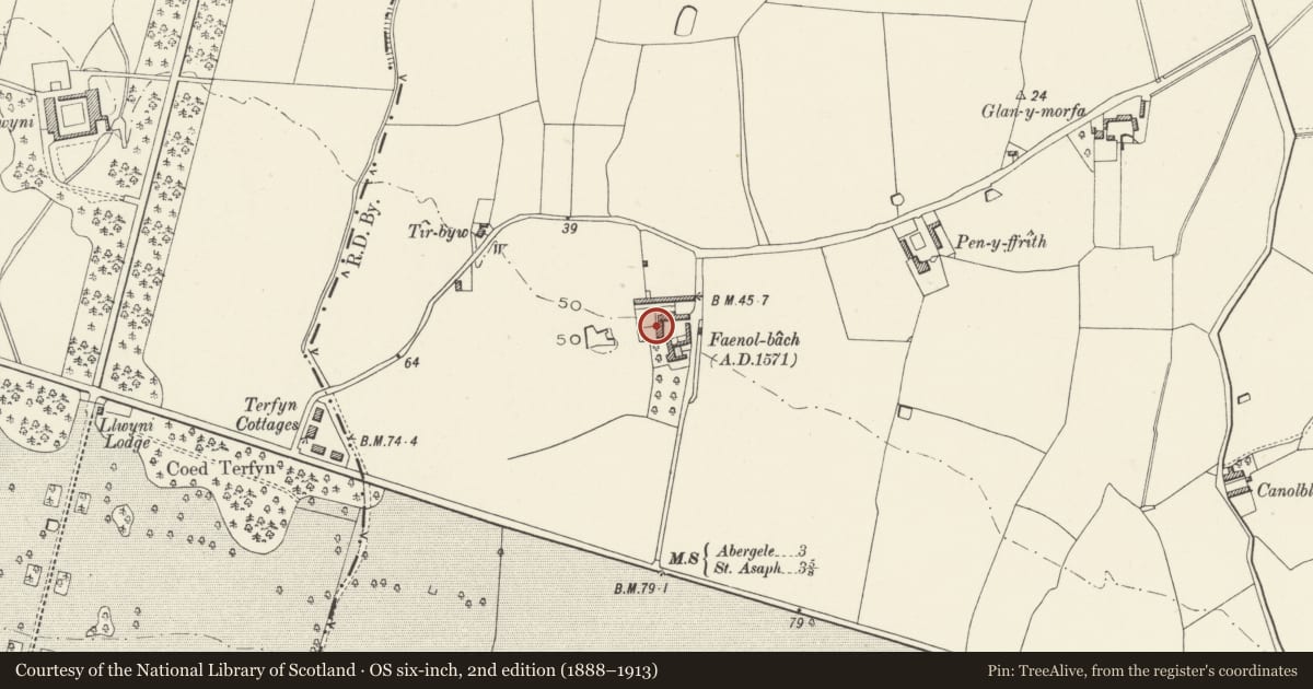
Slide toward Today to fade the historical sheet and see the modern map underneath.
David Rumsey Map Collection, Stanford LibrariesDavid Rumsey Map Collection, Stanford LibrariesNational Library of ScotlandDavid Rumsey Map Collection, Stanford LibrariesLlyfrgell Genedlaethol Cymru – The National Library of Wales
5 historical maps cover this location, the earliest the 1795 map "To Sir Watkin Williams-Wynn Bart ... the map of the six counties of North Wales is most humbly inscribed by his obedient humble servant" (Llyfrgell Genedlaethol Cymru – The National Library of Wales).
Historical maps covering this location
- 1795 · To Sir Watkin Williams-Wynn Bart ... the map of the six counties of North Wales is most… (Llyfrgell Genedlaethol Cymru – The National Library of Wales)
- 1883 · Watershed map England, Wales 3. (David Rumsey Map Collection, Stanford Libraries)
- 1898 · 95 Rhyl (Hills) (David Rumsey Map Collection, Stanford Libraries)
- 1901 · Sheet 9 and 10. (David Rumsey Map Collection, Stanford Libraries)
- 1963 · Map No. 36 - Local Government Commission for Wales : [Definitive maps showing proposed… (National Library of Scotland)
Cadw's description
Location
About 20m NW of Faenol-bach farmhouse.
History
Probably C17, may be contemporary with the enlargement of Faenol-bach farmhouse.
Exterior
A barn range in local axe-dressed uncoursed limestone masonry, with slate roof. Conspicuous raised and coped gables at each end, perhaps indicative of original thatch. Stonework much altered but retaining several slit vents. On the farmyard side there are large loft-hatches to right and left, a smaller loft opening left of centre, and 2 large doors below under a concrete lintel.
Interior
Not seen, but said to be 5-bays, originally with 3 storage bays and 2 threshing floors.
Reason for designation
A C17 barn which has retained much of its character notwithstanding alterations; listed also for group value with Faenol-bach farmhouse.
Nearby in the register
- Farm Range to N of Faenol-bach FarmyardAgriculture and Subsistenceunder 1 mi
- Outbuildings to N of Faenol-bachAgriculture and Subsistenceunder 1 mi
- Farm Ranges to W of Faenol-bach FarmyardAgriculture and Subsistenceunder 1 mi
- Faenol-bach with Domestic Boundary WallsDomesticunder 1 mi
Other entries of the same register within about three miles of this one, by straight line.