Cof Cymru: National Historic Assets of Wales · Wales
No. 1 Cross Houses
Montgomery, Powys, Wales
A Grade II listed building in Montgomery, Powys, designated on 16 April 1982.
The record
- Designation
- Listed building, Grade II
- Broad class
- Domestic
- Date of designation
- 16 April 1982
- Town
- Montgomery
- Community
- Montgomery
- Unitary authority
- Powys
- Country
- Wales
- Coordinates
- 52.56322, -3.14768
- Cadw reference
- 7956
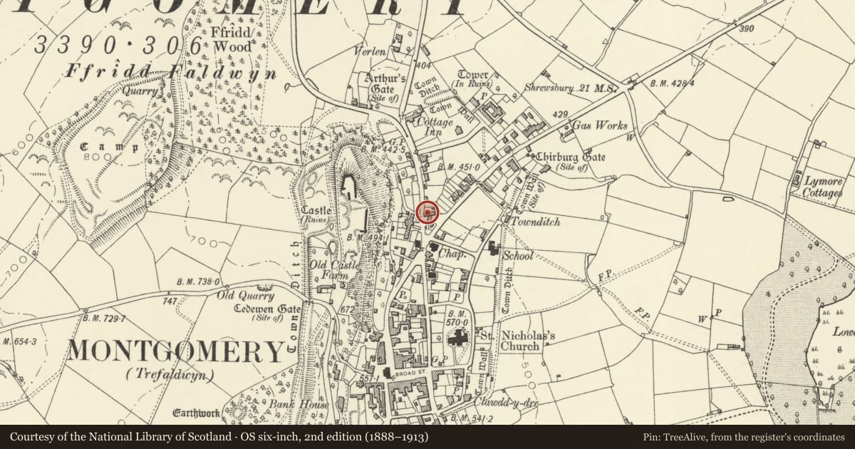
Slide toward Today to fade the historical sheet and see the modern map underneath.
David Rumsey Map Collection, Stanford LibrariesDavid Rumsey Map Collection, Stanford LibrariesDavid Rumsey Map Collection, Stanford LibrariesLlyfrgell Genedlaethol Cymru – The National Library of WalesDavid Rumsey Map Collection, Stanford Libraries
5 historical maps cover this location, the earliest the 1637 map "Particular description of Wales. Cambria seu Wallia" (David Rumsey Map Collection, Stanford Libraries).
Historical maps covering this location
- 1637 · Particular description of Wales. Cambria seu Wallia (David Rumsey Map Collection, Stanford Libraries)
- 1795 · To Sir Watkin Williams-Wynn Bart ... the map of the six counties of North Wales is most… (Llyfrgell Genedlaethol Cymru – The National Library of Wales)
- 1883 · Watershed map England, Wales 3. (David Rumsey Map Collection, Stanford Libraries)
- 1899 · 165 Montgomery (Hills) (David Rumsey Map Collection, Stanford Libraries)
- 1901 · Sheet 14. (David Rumsey Map Collection, Stanford Libraries)
Cadw's description
Location
Situated on left end of row of cottages, on corner of Pool Road.
History
End cottage of a row of four probably of C17 or C18 date, timber framed. No 1 is larger and may be earlier though cased in brick, probably in later C18. Square timber framing exposed in the E gable. The row is marked on 1833 map as owned by C.G. Humphreys of Bank House, No 1 occupied in 1839 by Mary Lewis. Shown on OS map of 1975 as Cross Lanes. Old photographs show No 1 with cross-windows each side of the door which has a gabled hood.
Exterior
End terrace house, painted brick with dentilled brick eaves and steep slate roof hipped to SW, gabled to E and with tall red brick stack to rear NW gable. One storey and attic, double-fronted with centre doorway between two window with cambered brick heads and modern glazing. Doorway had a gabled hood on brackets above old door frame with modern door with glazed panels, now within a late C20 glazed porch. Two small dormer windows on eaves with bargeboards and modern paired casements. Windowless brick W end wall. Modern addition to rear. E gable, above No 2 has exposed timber framing in square panels.
Interior
Interior not inspected.
Reason for designation
Included as a small Georgian brick house with significant evidence of earlier timber-framed origins.
Nearby in the register
- No. 2 Cross HousesDomesticunder 1 mi
- No. 3 Cross HousesDomesticunder 1 mi
- No. 4 Cross HousesDomesticunder 1 mi
- No. 3 Plough BankDomesticunder 1 mi
Other entries of the same register within about three miles of this one, by straight line.