Cof Cymru: National Historic Assets of Wales · Wales
Church Cottage
Montgomery, Powys, Wales
A Grade II listed building in Montgomery, Powys, designated on 30 March 1983.
The record
- Designation
- Listed building, Grade II
- Broad class
- Domestic
- Date of designation
- 30 March 1983
- Town
- Montgomery
- Community
- Montgomery
- Unitary authority
- Powys
- Country
- Wales
- Coordinates
- 52.56109, -3.14616
- Cadw reference
- 7951
Slide toward Today to fade the historical sheet and see the modern map underneath.
David Rumsey Map Collection, Stanford LibrariesDavid Rumsey Map Collection, Stanford LibrariesDavid Rumsey Map Collection, Stanford LibrariesLlyfrgell Genedlaethol Cymru – The National Library of WalesDavid Rumsey Map Collection, Stanford Libraries
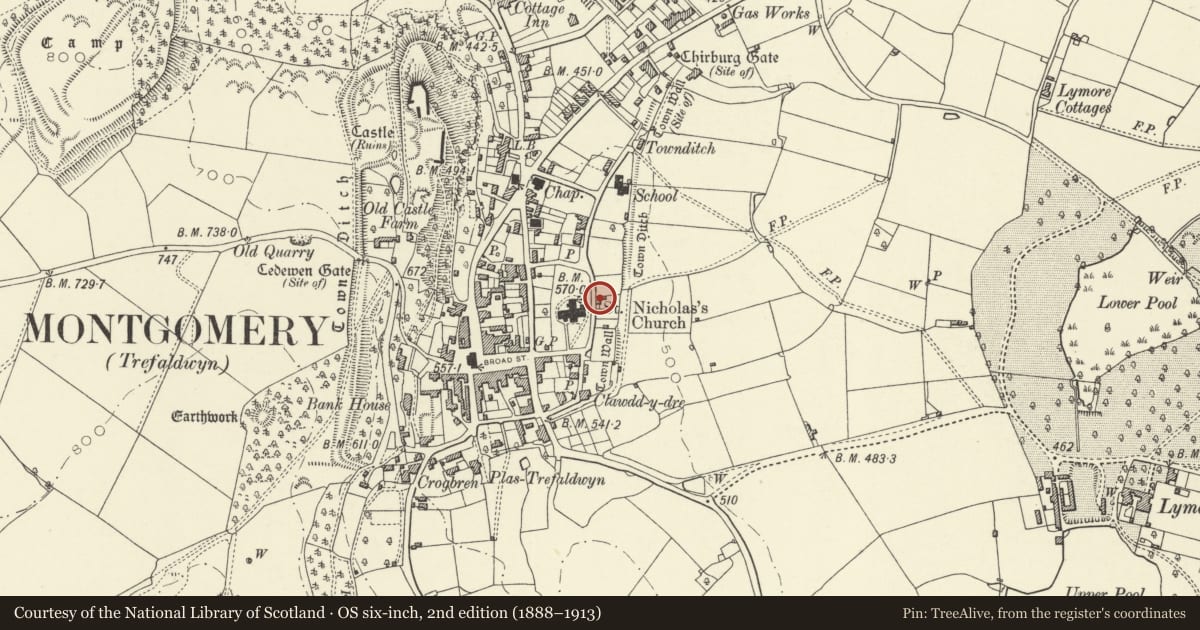
5 historical maps cover this location, the earliest the 1637 map "Particular description of Wales. Cambria seu Wallia" (David Rumsey Map Collection, Stanford Libraries).
Historical maps covering this location
- 1637 · Particular description of Wales. Cambria seu Wallia (David Rumsey Map Collection, Stanford Libraries)
- 1795 · To Sir Watkin Williams-Wynn Bart ... the map of the six counties of North Wales is most… (Llyfrgell Genedlaethol Cymru – The National Library of Wales)
- 1883 · Watershed map England, Wales 3. (David Rumsey Map Collection, Stanford Libraries)
- 1899 · 165 Montgomery (Hills) (David Rumsey Map Collection, Stanford Libraries)
- 1901 · Sheet 14. (David Rumsey Map Collection, Stanford Libraries)
Cadw's description
Location
Situated to E of churchyard, at right angles to road.
History
Earlier C19 small house probably associated with the church. A building is shown here on Tithe Map of 1839.
Exterior
Small house with heavy rubble stone end walls with coped shouldered gables framing stuccoed N and S facades. Slate eaves roof, brick E end stack, stone finial on W gable, to road. Two storeys. Blank stone W gable to road. S front of one bay with door to left. Four-panel door with trellised blind overlight in doorcase of panelled thin piers with big moulded consoles under horizontal moulded brackets carrying curved hood. To right of centre, on each floor, an iron small-paned three-light window with Gothic glazing bars in the head of each light, set flush to wall face, and with moulded hoodmould. The ground floor window is taller. Rear N two-light leaded casement to left on first floor, and a single-light stair-light to right. Modern rear extension.
Interior
Interior not inspected.
Reason for designation
Included for its special interest as an attractive small house with locally distinctive detail including iron Gothic windows.
Nearby in the register
- Marianne Lloyd memorial in churchyardReligious, Ritual and Funeraryunder 1 mi
- Parish Church of Saint NicholasReligious, Ritual and Funeraryunder 1 mi
- Sundial in churchyardGardens, Parks and Urban Spacesunder 1 mi
- Humphreys Memorial in churchyardReligious, Ritual and Funeraryunder 1 mi
Other entries of the same register within about three miles of this one, by straight line.