Cof Cymru: National Historic Assets of Wales · Wales
Churchyard wall, gate piers and gates
Montgomery, Powys, Wales
A Grade II listed building in Montgomery, Powys, designated on 30 March 1983.
The record
- Designation
- Listed building, Grade II
- Broad class
- Religious, Ritual and Funerary
- Date of designation
- 30 March 1983
- Town
- Montgomery
- Community
- Montgomery
- Unitary authority
- Powys
- Country
- Wales
- Coordinates
- 52.56047, -3.14677
- Cadw reference
- 7948
Slide toward Today to fade the historical sheet and see the modern map underneath.
David Rumsey Map Collection, Stanford LibrariesDavid Rumsey Map Collection, Stanford LibrariesDavid Rumsey Map Collection, Stanford LibrariesLlyfrgell Genedlaethol Cymru – The National Library of WalesDavid Rumsey Map Collection, Stanford Libraries
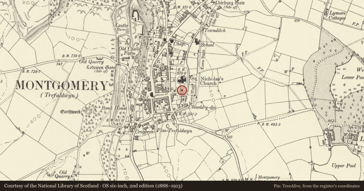
5 historical maps cover this location, the earliest the 1637 map "Particular description of Wales. Cambria seu Wallia" (David Rumsey Map Collection, Stanford Libraries).
Historical maps covering this location
- 1637 · Particular description of Wales. Cambria seu Wallia (David Rumsey Map Collection, Stanford Libraries)
- 1795 · To Sir Watkin Williams-Wynn Bart ... the map of the six counties of North Wales is most… (Llyfrgell Genedlaethol Cymru – The National Library of Wales)
- 1883 · Watershed map England, Wales 3. (David Rumsey Map Collection, Stanford Libraries)
- 1899 · 165 Montgomery (Hills) (David Rumsey Map Collection, Stanford Libraries)
- 1901 · Sheet 14. (David Rumsey Map Collection, Stanford Libraries)
Cadw's description
Location
Situated surrounding churchyard on three sides, the S and E sides to Church Bank, the N side to un-named lane back to Princes Street.
History
Retaining wall to churchyards, uncertain date with two gateways of c. 1865. One of the first jobs of David Davies of Llandinam is said to have been cutting the path from the gates to the S door as previously the churchyard path was raised to the height of the burial ground each side.
Exterior
Rubble stone retaining wall enclosing three sides of churchyard with curved corners at SE and NE. S entrance has later C19 monolith Gothic gatepiers of sandstone, with plinth, trefoil panel and gabled top with trefoil moulded cresting. Large cast-iron ornate Gothic gates with traceried design and cresting. Wrought iron scrolled iron overthrow with octagonal lamp holder. N entrance has plain C19 monolith gate piers and pair of smaller similar cast-iron Gothic gates.
Reason for designation
Included for group value with church and for quality of the cast-iron gates.
Nearby in the register
- BryneglwysDomesticunder 1 mi
- Bowling Green Cottage and railingsDomesticunder 1 mi
- Humphreys Memorial in churchyardReligious, Ritual and Funeraryunder 1 mi
- Sundial in churchyardGardens, Parks and Urban Spacesunder 1 mi
Other entries of the same register within about three miles of this one, by straight line.