Cof Cymru: National Historic Assets of Wales · Wales
The Green Dragon Inn
Trewern, Powys, Wales
A Grade II listed building in Buttington, Trewern, Powys, designated on 3 November 1981.
The record
- Designation
- Listed building, Grade II
- Broad class
- Commercial
- Date of designation
- 3 November 1981
- Locality
- Buttington
- Community
- Trewern
- Unitary authority
- Powys
- Country
- Wales
- Coordinates
- 52.67239, -3.11001
- Cadw reference
- 7908
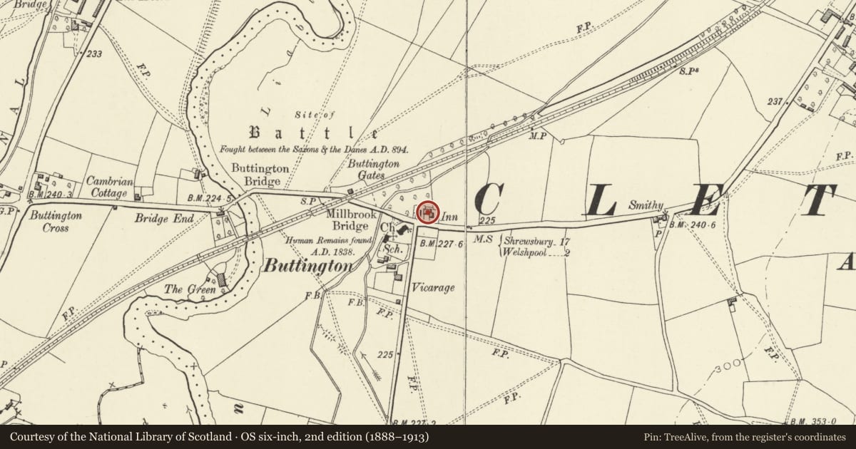
Slide toward Today to fade the historical sheet and see the modern map underneath.
David Rumsey Map Collection, Stanford LibrariesDavid Rumsey Map Collection, Stanford LibrariesDavid Rumsey Map Collection, Stanford LibrariesDavid Rumsey Map Collection, Stanford LibrariesLlyfrgell Genedlaethol Cymru – The National Library of Wales
5 historical maps cover this location, the earliest the 1795 map "To Sir Watkin Williams-Wynn Bart ... the map of the six counties of North Wales is most humbly inscribed by his obedient humble servant" (Llyfrgell Genedlaethol Cymru – The National Library of Wales).
Historical maps covering this location
- 1795 · To Sir Watkin Williams-Wynn Bart ... the map of the six counties of North Wales is most… (Llyfrgell Genedlaethol Cymru – The National Library of Wales)
- 1883 · Watershed map England, Wales 3. (David Rumsey Map Collection, Stanford Libraries)
- 1899 · 151 Welshpool (Hills) (David Rumsey Map Collection, Stanford Libraries)
- 1901 · Sheet 9 and 10. (David Rumsey Map Collection, Stanford Libraries)
- 1916 · Sheet 60. Shrewsbury. (David Rumsey Map Collection, Stanford Libraries)
Cadw's description
Location
Lying 300m E of Buttington Bridge.
Exterior
White painted brick with slate roof. Main range parallel to road, one storey and attic, 3 bays, extended in line by further 1-storey bay at W, partially timber framed and gable weatherboarded, and 2-bay 2-storey and attic front block added at E end at right angles. Timber casement windows. Entrance under gabled porch to centre bay of main range
Interior
C17 inn remodelled in C18 or early C19.
Reason for designation
Listed as a well-preserved inn on what is probably an early site at the river crossing.
Nearby in the register
- Church of All SaintsReligious, Ritual and Funeraryunder 1 mi
- Buttington VicarageDomesticunder 1 mi
- Buttington BridgeTransportunder 1 mi
- The MalthouseDomesticunder 1 mi
Other entries of the same register within about three miles of this one, by straight line.