Cof Cymru: National Historic Assets of Wales · Wales
Trawscoed Cottage
Guilsfield, Powys, Wales
A Grade II listed building in Guilsfield, Powys, designated on 11 March 1981.
The record
- Designation
- Listed building, Grade II
- Broad class
- Domestic
- Date of designation
- 11 March 1981
- Locality
- Guilsfield
- Community
- Guilsfield
- Unitary authority
- Powys
- Country
- Wales
- Coordinates
- 52.69675, -3.15618
- Cadw reference
- 7892
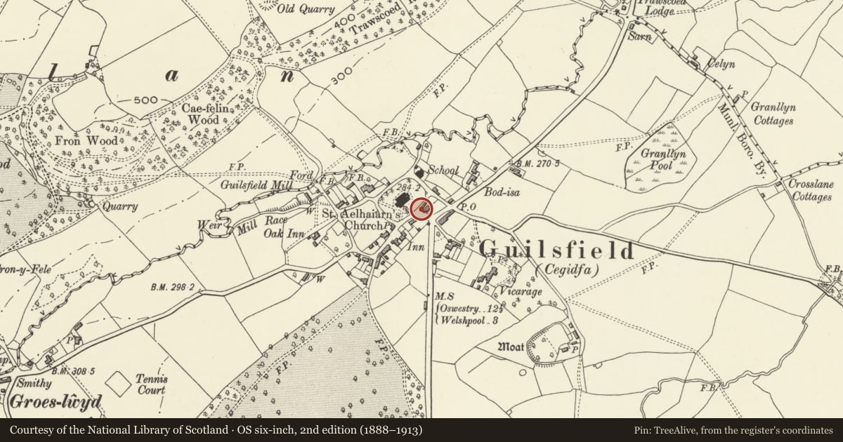
Slide toward Today to fade the historical sheet and see the modern map underneath.
David Rumsey Map Collection, Stanford LibrariesDavid Rumsey Map Collection, Stanford LibrariesDavid Rumsey Map Collection, Stanford LibrariesDavid Rumsey Map Collection, Stanford LibrariesLlyfrgell Genedlaethol Cymru – The National Library of Wales
5 historical maps cover this location, the earliest the 1795 map "To Sir Watkin Williams-Wynn Bart ... the map of the six counties of North Wales is most humbly inscribed by his obedient humble servant" (Llyfrgell Genedlaethol Cymru – The National Library of Wales).
Historical maps covering this location
- 1795 · To Sir Watkin Williams-Wynn Bart ... the map of the six counties of North Wales is most… (Llyfrgell Genedlaethol Cymru – The National Library of Wales)
- 1883 · Watershed map England, Wales 3. (David Rumsey Map Collection, Stanford Libraries)
- 1899 · 151 Welshpool (Hills) (David Rumsey Map Collection, Stanford Libraries)
- 1901 · Sheet 9 and 10. (David Rumsey Map Collection, Stanford Libraries)
- 1916 · Sheet 60. Shrewsbury. (David Rumsey Map Collection, Stanford Libraries)
Cadw's description
Location
Lying against the SE side of the churchyard, church of St Aelhaiarn.
History
Cottage, C16-C17.
Exterior
Timber framed with rendered infill panels on stone footings, slate hung on the W gable end. Slate roof. One storey with attic. Type C plan with door opposite stack containing one fireplace to centre bay. Boarded door, timber casement windows and small pentice dormer on the S side of the centre bay. End truss has collar with queen struts and a single tier of purlins. The framing is marked up for assembly with a gouge.
Interior
Chamfered spine beams. Timber framed wall to inner room at W end.
Reason for designation
An interesting survival of a sub-medieval single storey house at the centre of the village, and of group value with neighbouring items within the conservation area.
Nearby in the register
- Abercrombie House (Post Office and Stores)Domesticunder 1 mi
- Jones Monument, close to the south gatesof the churchyardReligious, Ritual and Funeraryunder 1 mi
- Church of St Aelhaiarn including Outbuilding to W end of N Aisle and outbuilding on W side of PorchReligious, Ritual and Funeraryunder 1 mi
- White Ash (Nos 1 and 2 Onnen Wen/White Ash)Domesticunder 1 mi
Other entries of the same register within about three miles of this one, by straight line.