Cof Cymru: National Historic Assets of Wales · Wales
34 High Street
Welshpool, Powys, Wales
A Grade II listed building in Welshpool, Powys, designated on 25 April 1950.
The record
- Designation
- Listed building, Grade II
- Broad class
- Domestic
- Date of designation
- 25 April 1950
- Locality
- Welshpool
- Community
- Welshpool
- Unitary authority
- Powys
- Country
- Wales
- Coordinates
- 52.66079, -3.15031
- Cadw reference
- 7807
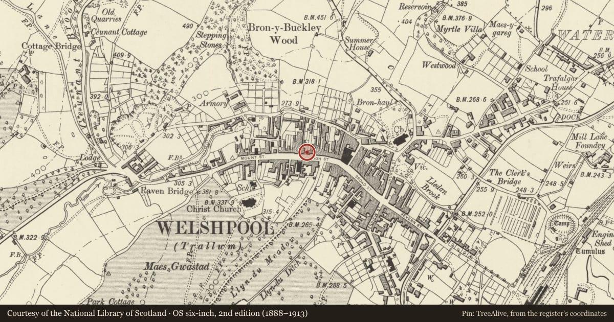
Slide toward Today to fade the historical sheet and see the modern map underneath.
David Rumsey Map Collection, Stanford LibrariesDavid Rumsey Map Collection, Stanford LibrariesDavid Rumsey Map Collection, Stanford LibrariesDavid Rumsey Map Collection, Stanford LibrariesLlyfrgell Genedlaethol Cymru – The National Library of Wales
5 historical maps cover this location, the earliest the 1795 map "To Sir Watkin Williams-Wynn Bart ... the map of the six counties of North Wales is most humbly inscribed by his obedient humble servant" (Llyfrgell Genedlaethol Cymru – The National Library of Wales).
Historical maps covering this location
- 1795 · To Sir Watkin Williams-Wynn Bart ... the map of the six counties of North Wales is most… (Llyfrgell Genedlaethol Cymru – The National Library of Wales)
- 1883 · Watershed map England, Wales 3. (David Rumsey Map Collection, Stanford Libraries)
- 1899 · 151 Welshpool (Hills) (David Rumsey Map Collection, Stanford Libraries)
- 1901 · Sheet 9 and 10. (David Rumsey Map Collection, Stanford Libraries)
- 1916 · Sheet 60. Shrewsbury. (David Rumsey Map Collection, Stanford Libraries)
Cadw's description
Location
On the E corner with Jehu Road.
Exterior
History: Probably built c1820, on a site with a longer history of occupation; possibly raised in height in the later C19 - the character of the upper storey and the pitch of the roof suggest a later date.
Exterior: Render over brick; slate roof with gable end stack. 3 storeys, 3-window range with entrance to left; lower rear wing. 6-panelled door with lozenge overlight in architrave with reeded pilasters, panelled rebates and dentilled cornice to projecting entablature. Alongside the doorway is a fine bow window with small panes, and enriched cornice. Upper windows are 20-pane sashes to first floor, later 4-pane sashes above with blind central window space. In the rear elevation is a cast-iron casement window with gothic interlace.
Railings enclose a narrow yard to the street: spike finials, and urns on principal posts.
An exceptionally well-detailed early C19 town house
Nearby in the register
- 36 High StreetDomesticunder 1 mi
- 11 High StreetDomesticunder 1 mi
- 10 High StreetDomesticunder 1 mi
- 31 High StreetDomesticunder 1 mi
Other entries of the same register within about three miles of this one, by straight line.