Cof Cymru: National Historic Assets of Wales · Wales
28 Broad Street
Welshpool, Powys, Wales
A Grade II listed building in Welshpool, Powys, designated on 11 March 1981.
The record
- Designation
- Listed building, Grade II
- Broad class
- Domestic
- Date of designation
- 11 March 1981
- Locality
- Welshpool
- Community
- Welshpool
- Unitary authority
- Powys
- Country
- Wales
- Coordinates
- 52.65968, -3.14779
- Cadw reference
- 7771
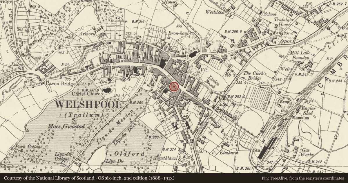
Slide toward Today to fade the historical sheet and see the modern map underneath.
David Rumsey Map Collection, Stanford LibrariesDavid Rumsey Map Collection, Stanford LibrariesDavid Rumsey Map Collection, Stanford LibrariesDavid Rumsey Map Collection, Stanford LibrariesLlyfrgell Genedlaethol Cymru – The National Library of Wales
5 historical maps cover this location, the earliest the 1795 map "To Sir Watkin Williams-Wynn Bart ... the map of the six counties of North Wales is most humbly inscribed by his obedient humble servant" (Llyfrgell Genedlaethol Cymru – The National Library of Wales).
Historical maps covering this location
- 1795 · To Sir Watkin Williams-Wynn Bart ... the map of the six counties of North Wales is most… (Llyfrgell Genedlaethol Cymru – The National Library of Wales)
- 1883 · Watershed map England, Wales 3. (David Rumsey Map Collection, Stanford Libraries)
- 1899 · 151 Welshpool (Hills) (David Rumsey Map Collection, Stanford Libraries)
- 1901 · Sheet 9 and 10. (David Rumsey Map Collection, Stanford Libraries)
- 1916 · Sheet 60. Shrewsbury. (David Rumsey Map Collection, Stanford Libraries)
Cadw's description
Location
In the block between the corner with Berriew Street and New Street.
Exterior
History: An inscribed keystone records the date 1808 with the initials M.M. (Margaret Meredith), rebuilding on a site earlier occupied by the Plough and Harrow Public House, and forming part of a wider series of early C19 rebuilding in this part of the town. Possibly rebuilt as a private house, but certainly in commercial use by the late C19.
Exterior: Brick with slate roof. 3 storeys, a wide 2-window range. Modern shop front occupies the entire ground floor, but upper storeys retain original character, with 16-pane sash windows to first floor, with painted sill and splayed lintels with stressed keystones; 8-pane sash windows with similar heads to second floor.
The modest early C19 building retains much of its character despite the modern shop front, and forms part of a group of domestic and commercial buildings at the centre of the town.
Reference: Ion Trant, The Changing Face of Welshpool, 1986, p.60.
Nearby in the register
- 29 Broad StreetCommercialunder 1 mi
- 27 Broad StreetCommercialunder 1 mi
- 26 Broad StreetCommercialunder 1 mi
- 25 Broad StreetCommercialunder 1 mi
Other entries of the same register within about three miles of this one, by straight line.