Cof Cymru: National Historic Assets of Wales · Wales
24 Broad Street
Welshpool, Powys, Wales
A Grade II listed building in Welshpool, Powys, designated on 11 March 1981.
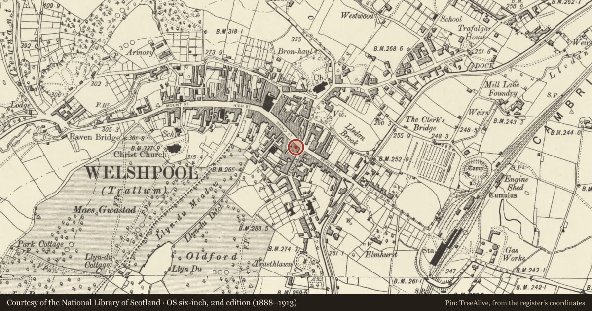
The record
- Designation
- Listed building, Grade II
- Broad class
- Commercial
- Date of designation
- 11 March 1981
- Locality
- Welshpool
- Community
- Welshpool
- Unitary authority
- Powys
- Country
- Wales
- Coordinates
- 52.65954, -3.14744
- Cadw reference
- 7767
Slide toward Today to fade the historical sheet and see the modern map underneath.
David Rumsey Map Collection, Stanford LibrariesDavid Rumsey Map Collection, Stanford LibrariesDavid Rumsey Map Collection, Stanford LibrariesDavid Rumsey Map Collection, Stanford LibrariesLlyfrgell Genedlaethol Cymru – The National Library of Wales
5 historical maps cover this location, the earliest the 1795 map "To Sir Watkin Williams-Wynn Bart ... the map of the six counties of North Wales is most humbly inscribed by his obedient humble servant" (Llyfrgell Genedlaethol Cymru – The National Library of Wales).
Historical maps covering this location
- 1795 · To Sir Watkin Williams-Wynn Bart ... the map of the six counties of North Wales is most… (Llyfrgell Genedlaethol Cymru – The National Library of Wales)
- 1883 · Watershed map England, Wales 3. (David Rumsey Map Collection, Stanford Libraries)
- 1899 · 151 Welshpool (Hills) (David Rumsey Map Collection, Stanford Libraries)
- 1901 · Sheet 9 and 10. (David Rumsey Map Collection, Stanford Libraries)
- 1916 · Sheet 60. Shrewsbury. (David Rumsey Map Collection, Stanford Libraries)
Cadw's description
Location
Next to the Midland Bank, near the corner with Berriew Street.
History
Probably built c1830, as part of a larger development with No 25. Almost certainly built as shop with accommodation.
Exterior
Brick with slate roof. 3 storeys, 2-window range. Ground floor occupied by early C20 shop front cutting into the first floor windows with its high dentilled fascia; central doorway flanked by plate glass windows with leaded upper lights. Upper storeys articulated by outer and central pilasters, and plain frieze band below the moulded eaves cornice. Sash windows with glazing bars (9-pane to first floor, probably cut down from 12-pane, 6-pane to upper storey), with flat arched brick heads.
Reason for designation
Included as a small early C19 commercial building which forms part of a group.
Nearby in the register
- Midland BankCommercialunder 1 mi
- 25 Broad StreetCommercialunder 1 mi
- 26 Broad StreetCommercialunder 1 mi
- 27 Broad StreetCommercialunder 1 mi
Other entries of the same register within about three miles of this one, by straight line.