Cof Cymru: National Historic Assets of Wales · Wales
No 7 Sarn-y-bryn-caled Cottages
Welshpool, Powys, Wales
A Grade II listed building in Sarn-y-bryn-caled, Welshpool, Powys, designated on 11 March 1981.
The record
- Designation
- Listed building, Grade II
- Broad class
- Domestic
- Date of designation
- 11 March 1981
- Locality
- Sarn-y-bryn-caled
- Community
- Welshpool
- Unitary authority
- Powys
- Country
- Wales
- Coordinates
- 52.63793, -3.15469
- Cadw reference
- 7753
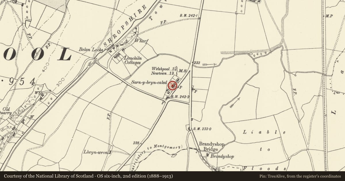
Slide toward Today to fade the historical sheet and see the modern map underneath.
David Rumsey Map Collection, Stanford LibrariesDavid Rumsey Map Collection, Stanford LibrariesDavid Rumsey Map Collection, Stanford LibrariesDavid Rumsey Map Collection, Stanford LibrariesLlyfrgell Genedlaethol Cymru – The National Library of Wales
5 historical maps cover this location, the earliest the 1795 map "To Sir Watkin Williams-Wynn Bart ... the map of the six counties of North Wales is most humbly inscribed by his obedient humble servant" (Llyfrgell Genedlaethol Cymru – The National Library of Wales).
Historical maps covering this location
- 1795 · To Sir Watkin Williams-Wynn Bart ... the map of the six counties of North Wales is most… (Llyfrgell Genedlaethol Cymru – The National Library of Wales)
- 1883 · Watershed map England, Wales 3. (David Rumsey Map Collection, Stanford Libraries)
- 1899 · 151 Welshpool (Hills) (David Rumsey Map Collection, Stanford Libraries)
- 1901 · Sheet 9 and 10. (David Rumsey Map Collection, Stanford Libraries)
- 1916 · Sheet 60. Shrewsbury. (David Rumsey Map Collection, Stanford Libraries)
Cadw's description
Location
The cottages are on the old line of the Welshpool-Newtown Road, cut-off by the Welshpool by-pass and now a by-road leading to the canal at Belan Lock
Exterior
History: The cottages form part of a small settlement, developed by the Powis Estate to house its agricultural workers, between c1830 and 1881. This pair was built between 1861 and 1871.
Description: Coursed and squared snecked local sandstone to main front, the rest brick; graded slate roof with axial brick stack. 2 storeys, each a single unit plan with shared rear wing. Paired central doorways - battened plank doors in simple shallow timber porches (No 7 retains the original, with decorative panelling to architrave). Flanking windows are iron small-paned casements, with flat arched voussoir heads to ground floor.
Part of a group of model cottages forming an excellent example of a small estate settlement which retains much of its original character.
Reference: Stephen Hughes, The Archaeology of the Montgomeryshire Canal, 1988, p.92.
Nearby in the register
- No 8 Sarn-y-bryn-caled CottagesDomesticunder 1 mi
- No 6 Sarn-y-bryn-caled CottagesDomesticunder 1 mi
- No 5 Sarn-y-bryn-caled CottagesDomesticunder 1 mi
- No 4 Sarn-y-bryn-caled CottagesDomesticunder 1 mi
Other entries of the same register within about three miles of this one, by straight line.