Cof Cymru: National Historic Assets of Wales · Wales
Gate House
Welshpool, Powys, Wales
A Grade II listed building in Llanerchydol, Welshpool, Powys, designated on 11 March 1981.
The record
- Designation
- Listed building, Grade II
- Broad class
- Transport
- Date of designation
- 11 March 1981
- Locality
- Llanerchydol
- Community
- Welshpool
- Unitary authority
- Powys
- Country
- Wales
- Coordinates
- 52.65863, -3.16320
- Cadw reference
- 7729
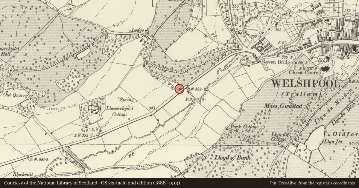
Slide toward Today to fade the historical sheet and see the modern map underneath.
David Rumsey Map Collection, Stanford LibrariesDavid Rumsey Map Collection, Stanford LibrariesDavid Rumsey Map Collection, Stanford LibrariesDavid Rumsey Map Collection, Stanford LibrariesLlyfrgell Genedlaethol Cymru – The National Library of Wales
5 historical maps cover this location, the earliest the 1795 map "To Sir Watkin Williams-Wynn Bart ... the map of the six counties of North Wales is most humbly inscribed by his obedient humble servant" (Llyfrgell Genedlaethol Cymru – The National Library of Wales).
Historical maps covering this location
- 1795 · To Sir Watkin Williams-Wynn Bart ... the map of the six counties of North Wales is most… (Llyfrgell Genedlaethol Cymru – The National Library of Wales)
- 1883 · Watershed map England, Wales 3. (David Rumsey Map Collection, Stanford Libraries)
- 1899 · 151 Welshpool (Hills) (David Rumsey Map Collection, Stanford Libraries)
- 1901 · Sheet 9 and 10. (David Rumsey Map Collection, Stanford Libraries)
- 1916 · Sheet 60. Shrewsbury. (David Rumsey Map Collection, Stanford Libraries)
Cadw's description
Location
Alongside the Llanfair Caereinion Road, on the NW side, 250m approx. from the roundabout to the W of Welshpool.
Exterior
History: Almost certainly built as a toll house for the Turnpike Road to Dolgellau, c1820.
Exterior: Rough random local rubble, the roof renewed with concrete tiles; ribbed brick stack to rear. 2 storeys, L- plan, with gabled wing advanced towards the road. Entrance in added porch in the angle of this wing and the range at right- angles with it. Wing has canted bay window to ground floor, and 4-centred arched head to 2-light casement above, in chamfered architrave. Similar windows in the gable end of the other range. All windows have ornamental cast-iron diamond lattice glazing.
Listed as a good example of an early C19 toll house, retaining much of its original Picturesque vocabulary.
Nearby in the register
- Second Lodge to Llanerchydol HallDomesticunder 1 mi
- Entrance gate, flanking walls and railings adjoining First Lodge to Llanerchydol HallDomesticunder 1 mi
- First Lodge to Llanerchydol HallDomesticunder 1 mi
- Christ ChurchReligious, Ritual and Funeraryunder 1 mi
Other entries of the same register within about three miles of this one, by straight line.