Cof Cymru: National Historic Assets of Wales · Wales
Upper Munlyn Farmhouse
Forden with Leighton and Trelystan, Powys, Wales
A Grade II listed building in Munlyn, Forden with Leighton and Trelystan, Powys, designated on 26 October 1953.
The record
- Designation
- Listed building, Grade II
- Broad class
- Domestic
- Date of designation
- 26 October 1953
- Locality
- Munlyn
- Community
- Forden with Leighton and Trelystan
- Unitary authority
- Powys
- Country
- Wales
- Coordinates
- 52.59890, -3.15754
- Cadw reference
- 7711
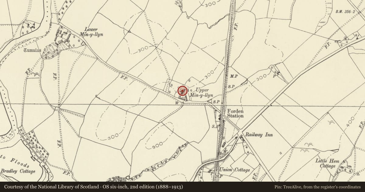
Slide toward Today to fade the historical sheet and see the modern map underneath.
David Rumsey Map Collection, Stanford LibrariesDavid Rumsey Map Collection, Stanford LibrariesDavid Rumsey Map Collection, Stanford LibrariesDavid Rumsey Map Collection, Stanford LibrariesLlyfrgell Genedlaethol Cymru – The National Library of Wales
5 historical maps cover this location, the earliest the 1795 map "To Sir Watkin Williams-Wynn Bart ... the map of the six counties of North Wales is most humbly inscribed by his obedient humble servant" (Llyfrgell Genedlaethol Cymru – The National Library of Wales).
Historical maps covering this location
- 1795 · To Sir Watkin Williams-Wynn Bart ... the map of the six counties of North Wales is most… (Llyfrgell Genedlaethol Cymru – The National Library of Wales)
- 1883 · Watershed map England, Wales 3. (David Rumsey Map Collection, Stanford Libraries)
- 1899 · 151 Welshpool (Hills) (David Rumsey Map Collection, Stanford Libraries)
- 1901 · Sheet 9 and 10. (David Rumsey Map Collection, Stanford Libraries)
- 1916 · Sheet 60. Shrewsbury. (David Rumsey Map Collection, Stanford Libraries)
Cadw's description
Location
Located W of the level crossing, on a minor road leading down to the River Severn, and set above and behind the farm buildings.
History
A large C17 'L'-plan timber framed house, the timbering rendered over in 1955.
Exterior
Timber framing, 4 panels high, set on a stone base, and rendered over and painted in the mid C20. Slate roof. Two storeys, entrance in the re-entrant angle within a lean-to porch, and the main parlour in the E-W wing, which appears to be slightly jettied under the rendering, and has a hipped and canted bay window overlooking the garden. Lean-to on the W side of the left wing. Major stack of 4 star-plan brick flues, and an added stack on the left wing. Windows renewed in the 1990's; timber with paned double glazed inserts.
Interior
Not accessible at the time of inspection (October 1996).
Reason for designation
Listed as a fine late C17 Severn-valley type timber-framed house retaining original form.
Nearby in the register
- Forden Signal BoxTransportunder 1 mi
- Pound Fields CottageDomesticunder 1 mi
- Lower Min-y-Llyn Castle MoundMotteunder 1 mi
- Camlad House (formerly known as Bryn Hyfred Hospital)Industrialunder 1 mi
Other entries of the same register within about three miles of this one, by straight line.