Cof Cymru: National Historic Assets of Wales · Wales
Pont Eyarth
Llanfair Dyffryn Clwyd, Denbighshire, Wales
A Grade II listed building in Llanfair Dyffryn Clwyd, Denbighshire, designated on 19 July 1966.
The record
- Designation
- Listed building, Grade II
- Broad class
- Transport
- Date of designation
- 19 July 1966
- Locality
- Llanfair Dyffryn Clwyd
- Community
- Llanfair Dyffryn Clwyd
- Unitary authority
- Denbighshire
- Country
- Wales
- Coordinates
- 53.08773, -3.30507
- Cadw reference
- 771
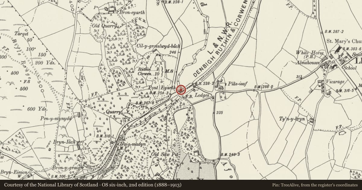
Slide toward Today to fade the historical sheet and see the modern map underneath.
David Rumsey Map Collection, Stanford LibrariesDavid Rumsey Map Collection, Stanford LibrariesLlyfrgell Genedlaethol Cymru – The National Library of WalesDavid Rumsey Map Collection, Stanford LibrariesDavid Rumsey Map Collection, Stanford Libraries
5 historical maps cover this location, the earliest the 1795 map "To Sir Watkin Williams-Wynn Bart ... the map of the six counties of North Wales is most humbly inscribed by his obedient humble servant" (Llyfrgell Genedlaethol Cymru – The National Library of Wales).
Historical maps covering this location
- 1795 · To Sir Watkin Williams-Wynn Bart ... the map of the six counties of North Wales is most… (Llyfrgell Genedlaethol Cymru – The National Library of Wales)
- 1830 · V.3:11-15:XV. Britisches Reich. A. Kon: England. b. Frstenthum Wales: Shire: 37-40 (David Rumsey Map Collection, Stanford Libraries)
- 1883 · Watershed map England, Wales 3. (David Rumsey Map Collection, Stanford Libraries)
- 1898 · 121 Wrexham (Hills) (David Rumsey Map Collection, Stanford Libraries)
- 1901 · Sheet 9 and 10. (David Rumsey Map Collection, Stanford Libraries)
Cadw's description
Location
Over the Avon Clwyd, 1km west of Llanfair Dyffryn Clwyd.
History
A fine county bridge of the C17 or C18.
Exterior
A bridge of a single large segmental arch in hammer-dressed local limestone masonry. The bridge common stonework is set slightly forward of the faces of the voussoirs, and there is a slight string course at the base of the parapet. At each end of the span on each face there is a slight turn-out to a buttress, and each corner is protected from traffic damage on the inside by means of a stone bollard. The carriageway rises gently from each side to a slight central hump, and is about 3½ metres wide between the parapets. The land approaches at both ends are faced in similar masonry but are a little wider.
The bridge parapets are massive and have triangular copings.
Reason for designation
A particularly fine county bridge which has fully retained its character.
Nearby in the register
- Pont Eyarth (partly in Llanfair Dyffryn Clwyd community)Transportunder 1 mi
- Gatelodge to Eyarth HouseDomesticunder 1 mi
- LimekilnIndustrialunder 1 mi
- Eyarth HouseDomesticunder 1 mi
Other entries of the same register within about three miles of this one, by straight line.