Cof Cymru: National Historic Assets of Wales · Wales
Former Cartshed and Byre at Pen-y-Cefn Farm
Cilcain, Flintshire, Wales
A Grade II listed building in Cefn, Cilcain, Flintshire, designated on 16 October 1995.
The record
- Designation
- Listed building, Grade II
- Broad class
- Agriculture and Subsistence
- Date of designation
- 16 October 1995
- Locality
- Cefn
- Community
- Cilcain
- Unitary authority
- Flintshire
- Country
- Wales
- Coordinates
- 53.19152, -3.21564
- Cadw reference
- 7575
Slide toward Today to fade the historical sheet and see the modern map underneath.
David Rumsey Map Collection, Stanford LibrariesDavid Rumsey Map Collection, Stanford LibrariesDavid Rumsey Map Collection, Stanford LibrariesDavid Rumsey Map Collection, Stanford LibrariesLlyfrgell Genedlaethol Cymru – The National Library of Wales
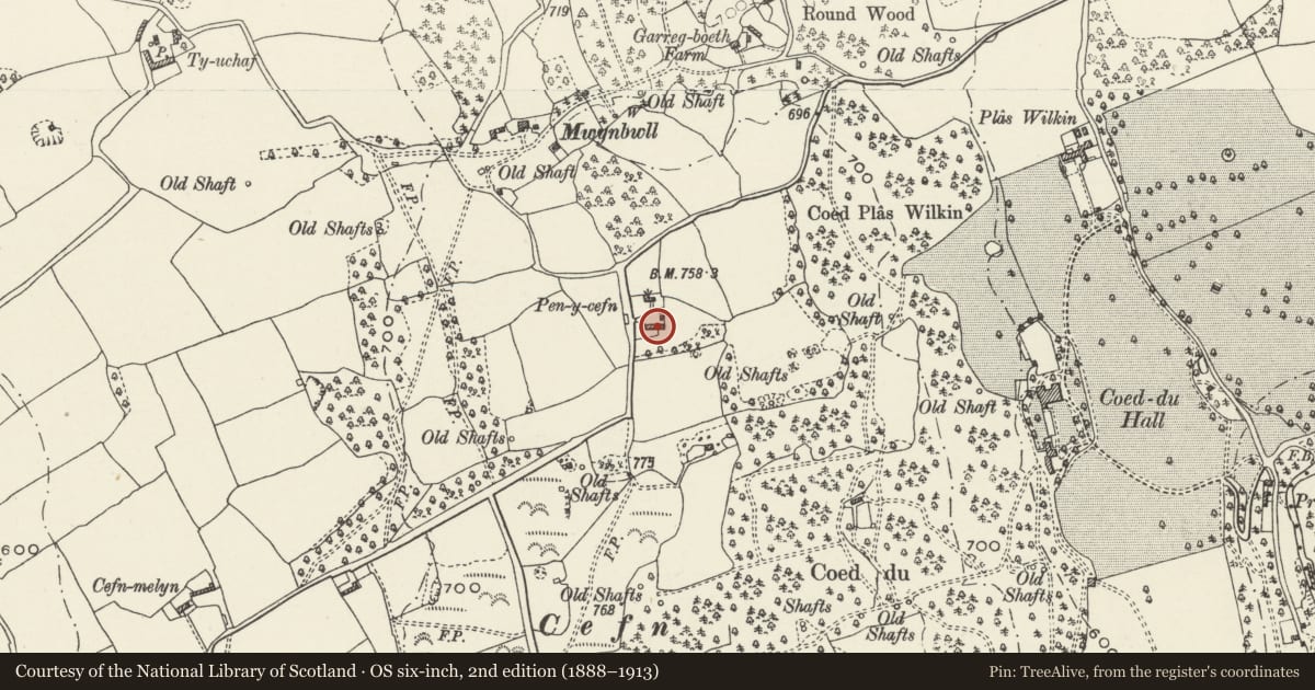
5 historical maps cover this location, the earliest the 1795 map "To Sir Watkin Williams-Wynn Bart ... the map of the six counties of North Wales is most humbly inscribed by his obedient humble servant" (Llyfrgell Genedlaethol Cymru – The National Library of Wales).
Historical maps covering this location
- 1795 · To Sir Watkin Williams-Wynn Bart ... the map of the six counties of North Wales is most… (Llyfrgell Genedlaethol Cymru – The National Library of Wales)
- 1883 · Watershed map England, Wales 3. (David Rumsey Map Collection, Stanford Libraries)
- 1898 · 108 Flint (Hills) (David Rumsey Map Collection, Stanford Libraries)
- 1898 · 108 Flint (Outline) (David Rumsey Map Collection, Stanford Libraries)
- 1901 · Sheet 9 and 10. (David Rumsey Map Collection, Stanford Libraries)
Cadw's description
Location
Situated opposite the house at Pen-y-cefn, set at right-angles to the road.
History
Perhaps C17 or earlier C18, the barn probably originated as a cartshed and byre, the arched cartshed opening was later blocked and a smaller door inserted. Two successive additions were made to the left, probably in the C19.
Exterior
Rubble with roughly squared quoins, slate roof. To the right is a blocked arched entrance with a door set in it. To the left of this a series of 3 doors, the central one taller than the others. A vertical joint separates this from a cartshed with loft over and a higher roofline. Doors are generally plank doors with strap hinges.
Interior
Not accessible at time of 1995 survey.
Reason for designation
Listed for group value with Pen-y-cefn farmhouse.
Nearby in the register
- Pen-y-CefnDomesticunder 1 mi
- Coed Du HospitalHealth and Welfareunder 1 mi
- Plas Wilkin (Including attached farmyard ranges)Domesticunder 1 mi
- Bath HouseDomesticunder 1 mi
Other entries of the same register within about three miles of this one, by straight line.