Cof Cymru: National Historic Assets of Wales · Wales
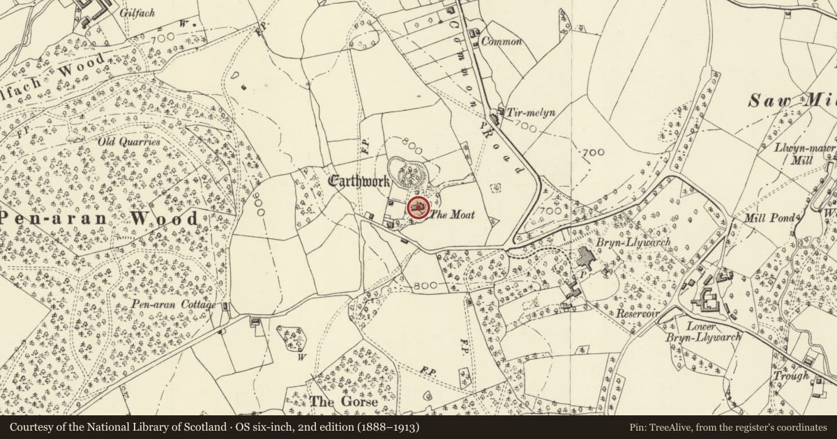
The Moat
Kerry, Powys, Wales
A Grade II listed building in The Common, Newtown, Kerry, Powys, designated on 10 March 1953.
The record
- Designation
- Listed building, Grade II
- Broad class
- Domestic
- Date of designation
- 10 March 1953
- Locality
- The Common
- Town
- Newtown
- Community
- Kerry
- Unitary authority
- Powys
- Country
- Wales
- Coordinates
- 52.49599, -3.25761
- Cadw reference
- 7564
Slide toward Today to fade the historical sheet and see the modern map underneath.
David Rumsey Map Collection, Stanford LibrariesDavid Rumsey Map Collection, Stanford LibrariesDavid Rumsey Map Collection, Stanford LibrariesDavid Rumsey Map Collection, Stanford LibrariesDavid Rumsey Map Collection, Stanford Libraries
5 historical maps cover this location, the earliest the 1608 map "(13) Cambriae Typus." (David Rumsey Map Collection, Stanford Libraries).
Historical maps covering this location
- 1608 · (13) Cambriae Typus. (David Rumsey Map Collection, Stanford Libraries)
- 1637 · Particular description of Wales. Cambria seu Wallia (David Rumsey Map Collection, Stanford Libraries)
- 1883 · Watershed map England, Wales 3. (David Rumsey Map Collection, Stanford Libraries)
- 1899 · 165 Montgomery (Hills) (David Rumsey Map Collection, Stanford Libraries)
- 1901 · Sheet 14. (David Rumsey Map Collection, Stanford Libraries)
Cadw's description
Location
Located on the S side of an important later C12 motte and bailey castle, called Kerry Moat, the centre of the cwmwd of Ceri in Maelienydd. The Kerry moat is a Scheduled Ancient Monument (No. MG 050).
History
The house was formerly the vicarage, built 1810 for the Rev. John Jenkins, under the influence of John Nash. Jenkins (1770-1829), known as Ifor Ceri (Ifor Hael o Geri), was a noted musicologist and antiquary and was an important member of Iolo Morganwg's gorsedd in 1819, joint founder of the Cambrian Society, active in the Honourable Society of Cymmrodorion, and contributor to The Topographical Dictionary of Wales (1811). He kept open house here for artists and musicians during his incumbency (1807-1829). Items from his collection of traditional folk music were published in Ancient Welsh Music (1839), and elsewhere. He was also influential in the resurgence of national interest in eisteddfodau.
Exterior
Brickwork, partly pebbledashed, with brick quoins, and hipped slate roofs. The plan consists of a long 4-bay range, with a central rear extension, a cross wing with semi-circular front at the E end containing the main reception room, and a further cross wing, probably a later addition at the W.
Interior
Not accessible at time of inspection (January 1996)
Reason for designation
Included as a good and largely unaltered example of the Regency picturesque style of country villa such as was adopted by Nash after c1800, and of special interest for its association with Ifor Ceri.
Nearby in the register
- The Moat Mound and Bailey CastleMotte and Baileyunder 1 mi
- Brynllywarch Hall SchoolEducationunder 1 mi
- Former Malthouse at The Herbert ArmsNo class recordedunder 1 mi
- Dolforgan Lodge (East)Domesticunder 1 mi
Other entries of the same register within about three miles of this one, by straight line.