Cof Cymru: National Historic Assets of Wales · Wales
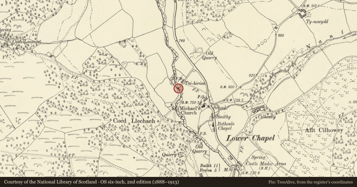
Bridge to SW of Traihirion (partly in Merthyr Cynog community)
Honddu Isaf, Powys, Wales
A Grade II listed building in Lower Chapel, Brecon, Honddu Isaf, Powys, designated on 3 February 1992.
The record
- Designation
- Listed building, Grade II
- Broad class
- Transport
- Date of designation
- 3 February 1992
- Locality
- Lower Chapel
- Town
- Brecon
- Community
- Honddu Isaf
- Unitary authority
- Powys
- Country
- Wales
- Coordinates
- 52.01322, -3.41966
- Cadw reference
- 7521
Slide toward Today to fade the historical sheet and see the modern map underneath.
David Rumsey Map Collection, Stanford LibrariesDavid Rumsey Map Collection, Stanford LibrariesDavid Rumsey Map Collection, Stanford LibrariesDavid Rumsey Map Collection, Stanford LibrariesDavid Rumsey Map Collection, Stanford Libraries
5 historical maps cover this location, the earliest the 1608 map "(13) Cambriae Typus." (David Rumsey Map Collection, Stanford Libraries).
Historical maps covering this location
- 1608 · (13) Cambriae Typus. (David Rumsey Map Collection, Stanford Libraries)
- 1636 · Cornubia : Devonia, Somersetus, Dorcestria, Wiltonia, Glocestria ... (David Rumsey Map Collection, Stanford Libraries)
- 1856 · 42. Brecon. (David Rumsey Map Collection, Stanford Libraries)
- 1898 · 213 Brecon (Hills) (David Rumsey Map Collection, Stanford Libraries)
- 1901 · Sheet 14. (David Rumsey Map Collection, Stanford Libraries)
Cadw's description
Location
On northern edge of Lower Chapel, spanning the Afon Honddu approximately 0.5km upstream from the road bridge over the river; on the boundary between Honddu Isaf and Merthyr Cynog communities. Reached along track past Taihirion; on an 'S' bend in river.
History
Late C17 to early C18 packhorse bridge over the Afon Honddu, a single arch without parapets, one of the last surviving in the area (another at Aberbran Fach, Yscir / Trallong communities). The roadway is higher and undulating to sides, probably from wheeled traffic rather than indicating lost parapets.
Exterior
Packhorse bridge, humped single arch without parapets. Segmental arch with thin stone voussoirs, the crown of the arch with just thin coping stones over, some rubble stone in spandrels. Cobbled roadway, higher and undulating to sides. Eroded abutments on upstream side together with resulting movement in soffit.
Reason for designation
Included for special historic interest as a rare surviving packhorse bridge.
Nearby in the register
- Bridge to SW of Traihirion (partly in Honddu Isaf community)Transportunder 1 mi
- Bridge HouseDomesticunder 1 mi
- Milestone on B4520Transportunder 1 mi
- Castell MadocDomesticunder 1 mi
Other entries of the same register within about three miles of this one, by straight line.