Cof Cymru: National Historic Assets of Wales · Wales
Castle Cottage
Llanfihangel Cwmdu with Bwlch and Cathedine, Powys, Wales
A Grade II listed building in Tretower, Llanfihangel Cwmdu with Bwlch and Cathedine, Powys, designated on 11 May 1990.
The record
- Designation
- Listed building, Grade II
- Broad class
- Domestic
- Date of designation
- 11 May 1990
- Locality
- Tretower
- Community
- Llanfihangel Cwmdu with Bwlch and Cathedine
- Unitary authority
- Powys
- Country
- Wales
- Coordinates
- 51.88441, -3.18560
- Cadw reference
- 7505
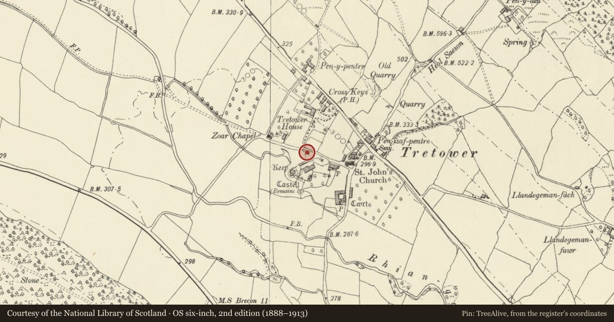
Slide toward Today to fade the historical sheet and see the modern map underneath.
David Rumsey Map Collection, Stanford LibrariesDavid Rumsey Map Collection, Stanford LibrariesDavid Rumsey Map Collection, Stanford LibrariesDavid Rumsey Map Collection, Stanford LibrariesDavid Rumsey Map Collection, Stanford Libraries
5 historical maps cover this location, the earliest the 1636 map "Cornubia : Devonia, Somersetus, Dorcestria, Wiltonia, Glocestria ..." (David Rumsey Map Collection, Stanford Libraries).
Historical maps covering this location
- 1636 · Cornubia : Devonia, Somersetus, Dorcestria, Wiltonia, Glocestria ... (David Rumsey Map Collection, Stanford Libraries)
- 1856 · 42. Brecon. (David Rumsey Map Collection, Stanford Libraries)
- 1895 · Sheet 11. Ordnance Survey of England and Wales. (David Rumsey Map Collection, Stanford Libraries)
- 1896 · 214 Talgarth (Hills) (David Rumsey Map Collection, Stanford Libraries)
- 1901 · Sheet 14. (David Rumsey Map Collection, Stanford Libraries)
Cadw's description
Location
On S side of a minor road immediately N of Tretower Castle.
History
A cottage existed on the site by 1538. The present cottage is a modification with dormers and gable openings.
Exterior
One-and-a-half storey, double fronted cottage of rubble stone and slate roof with end stone stacks. Openings in the lower storey under renewed timber lintels, and gabled dormers. Inserted openings in gable ends with timber lintels; lean-to at rear.
Interior
Stop-chamfered cross beams are closely spaced with no joists. Fireplaces at both ends have projecting chimney breast and hall fireplace has a stone stairs to R. Three-bay roof with upper crucks (possibly re-used from a dwelling shown here on 1538 estate map) with collars and stop-chamfered tie beams.
Reason for designation
Listed notwithstanding recent alterations for the special interest of the early origins and proximity to Tretower Castle.
Nearby in the register
- Tretower CastleCastleunder 1 mi
- Tretower CastleDefenceunder 1 mi
- Ty LlysDomesticunder 1 mi
- Tretower Shrunken Medieval SettlementShrunken Medieval Villageunder 1 mi
Other entries of the same register within about three miles of this one, by straight line.