Cof Cymru: National Historic Assets of Wales · Wales
The Bridge End Inn
Talgarth, Powys, Wales
A Grade II listed building in Talgarth, Powys, designated on 4 January 1984.
The record
- Designation
- Listed building, Grade II
- Broad class
- Commercial
- Date of designation
- 4 January 1984
- Locality
- Talgarth
- Community
- Talgarth
- Unitary authority
- Powys
- Country
- Wales
- Coordinates
- 51.99556, -3.23266
- Cadw reference
- 7473
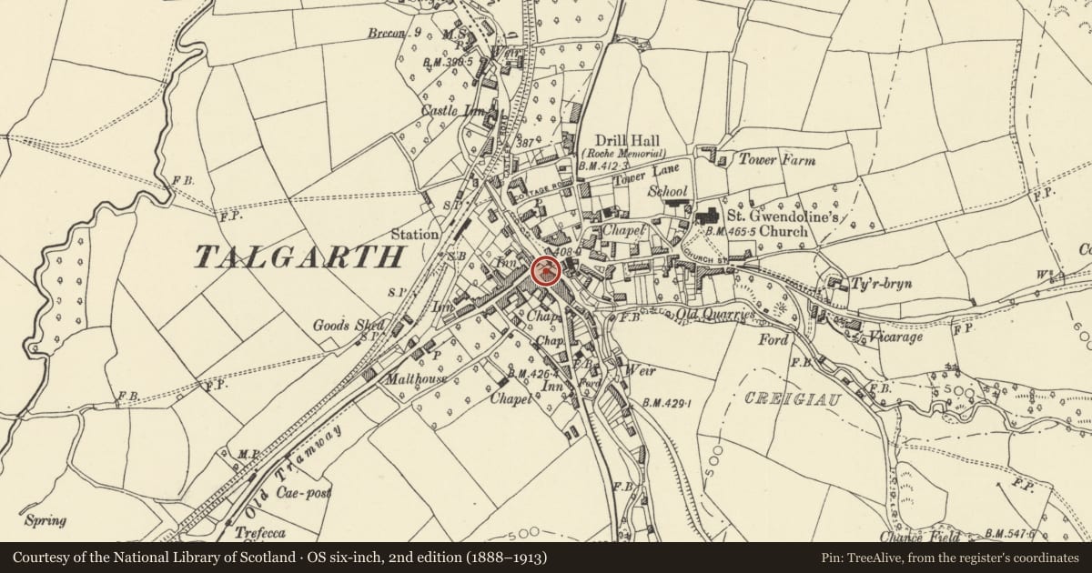
Slide toward Today to fade the historical sheet and see the modern map underneath.
David Rumsey Map Collection, Stanford LibrariesDavid Rumsey Map Collection, Stanford LibrariesDavid Rumsey Map Collection, Stanford LibrariesDavid Rumsey Map Collection, Stanford LibrariesDavid Rumsey Map Collection, Stanford Libraries
5 historical maps cover this location, the earliest the 1608 map "(13) Cambriae Typus." (David Rumsey Map Collection, Stanford Libraries).
Historical maps covering this location
- 1608 · (13) Cambriae Typus. (David Rumsey Map Collection, Stanford Libraries)
- 1636 · Cornubia : Devonia, Somersetus, Dorcestria, Wiltonia, Glocestria ... (David Rumsey Map Collection, Stanford Libraries)
- 1856 · 42. Brecon. (David Rumsey Map Collection, Stanford Libraries)
- 1896 · 214 Talgarth (Hills) (David Rumsey Map Collection, Stanford Libraries)
- 1901 · Sheet 14. (David Rumsey Map Collection, Stanford Libraries)
Cadw's description
Location
Located immediately to the SW of the River Enig bridge, on the corner of Regent Street.
Exterior
Hostelry, early C19 probably incorporating C18 work (Deed of 1762). Pebbledashed rubble stone with slate roof. Three storeys and basement, four window bays, with 2-bay rear wing containing an assembly room on an upper floor along the river frontage. Entrance in the third bay, a panelled door with overlight. Four paned later C19 sash windows, but a sixteen paned sash window on left. On first floor casement window with margin lights over door, and 4 square sash windows to second floor. End stacks and E gable limewashed rubble, the W gable rendered and painted with c1920's advertisements. Corner reinforced with iron. Two-bay rear extension has stone slates and door to river bank. C20 brick building in re-entrant angle.
Interior
Boxed spine beams. C18 fireplace surround with eared architrave. Steps to former assembly room at front of building, lit by sash window.
Reason for designation
Included as of group value with Tower House and Talgarth Bridge in the centre of the town.
Nearby in the register
- Talgarth BridgeTransportunder 1 mi
- Tower House including attached shopDomesticunder 1 mi
- Bridge HouseDomesticunder 1 mi
- Talgarth MillIndustrialunder 1 mi
Other entries of the same register within about three miles of this one, by straight line.