Cof Cymru: National Historic Assets of Wales · Wales
The White House
Builth, Powys, Wales
A Grade II listed building in Builth, Powys, designated on 16 September 1991.
The record
- Designation
- Listed building, Grade II
- Broad class
- Domestic
- Date of designation
- 16 September 1991
- Community
- Builth
- Unitary authority
- Powys
- Country
- Wales
- Coordinates
- 52.15040, -3.39797
- Cadw reference
- 7427
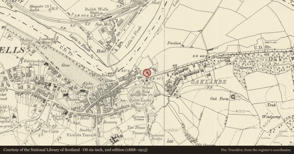
Slide toward Today to fade the historical sheet and see the modern map underneath.
David Rumsey Map Collection, Stanford LibrariesDavid Rumsey Map Collection, Stanford LibrariesDavid Rumsey Map Collection, Stanford LibrariesDavid Rumsey Map Collection, Stanford LibrariesDavid Rumsey Map Collection, Stanford Libraries
5 historical maps cover this location, the earliest the 1608 map "(13) Cambriae Typus." (David Rumsey Map Collection, Stanford Libraries).
Historical maps covering this location
- 1608 · (13) Cambriae Typus. (David Rumsey Map Collection, Stanford Libraries)
- 1637 · Particular description of Wales. Cambria seu Wallia (David Rumsey Map Collection, Stanford Libraries)
- 1883 · Watershed map England, Wales 3. (David Rumsey Map Collection, Stanford Libraries)
- 1899 · 196 Builth (Hills) (David Rumsey Map Collection, Stanford Libraries)
- 1901 · Sheet 14. (David Rumsey Map Collection, Stanford Libraries)
Cadw's description
Location
Farmhouse on prominent site on bend in road, with walled garden in front.
History
Partly C17 with additions of earlier C18 and alterations c. 1800.
Exterior
Linear plan with added lower unit to right, plus porch.
Slate roof, rubble masonry chimneys and walls, chimney to extension in banded brick.
Main section 2 storeyed, 3 windows wide. Small pane sash windows arranged symmetrically around door which is covered by later gabled porch. First floor windows set at eaves, central window narrower and with heavier sill. Window openings on ground floor have segmental arched heads with rubble voussoirs. Window to cellar.
Extension single storey. over cellar. Front has, modern window (tripartite sash) in wide, blocked opening (perhaps once a doorway) and cellar window below.
Rear much altered, and is 4 windows broad, in main section, but retains on first floor, one tall window, mullioned and transomed, perhaps c. 1700. Main section of building has blocked doorway (opposite front door) which now contains segmental-headed window. Doorway to extension is modern, original doorway now a window.
Nearby in the register
- Builth CastleMotte and Baileyunder 1 mi
- Telephone Call-boxCommunicationsunder 1 mi
- Pillar BoxCommunicationsunder 1 mi
- Wyeside Arts CentreRecreationalunder 1 mi
Other entries of the same register within about three miles of this one, by straight line.