Cof Cymru: National Historic Assets of Wales · Wales
Gates and Gatepiers to Llanrhydd Hall
Llanbedr Dyffryn Clwyd, Denbighshire, Wales
A Grade II listed building in Llanrhydd, Llanbedr Dyffryn Clwyd, Denbighshire, designated on 19 July 1966.
The record
- Designation
- Listed building, Grade II
- Broad class
- Domestic
- Date of designation
- 19 July 1966
- Locality
- Llanrhydd
- Community
- Llanbedr Dyffryn Clwyd
- Unitary authority
- Denbighshire
- Country
- Wales
- Coordinates
- 53.11041, -3.28658
- Cadw reference
- 742
Slide toward Today to fade the historical sheet and see the modern map underneath.
David Rumsey Map Collection, Stanford LibrariesDavid Rumsey Map Collection, Stanford LibrariesLlyfrgell Genedlaethol Cymru – The National Library of WalesDavid Rumsey Map Collection, Stanford LibrariesDavid Rumsey Map Collection, Stanford Libraries
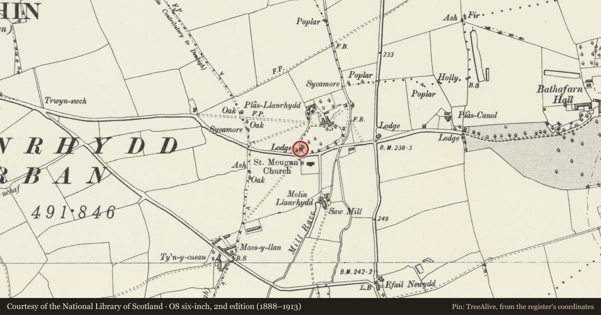
5 historical maps cover this location, the earliest the 1795 map "To Sir Watkin Williams-Wynn Bart ... the map of the six counties of North Wales is most humbly inscribed by his obedient humble servant" (Llyfrgell Genedlaethol Cymru – The National Library of Wales).
Historical maps covering this location
- 1795 · To Sir Watkin Williams-Wynn Bart ... the map of the six counties of North Wales is most… (Llyfrgell Genedlaethol Cymru – The National Library of Wales)
- 1830 · V.3:11-15:XV. Britisches Reich. A. Kon: England. b. Frstenthum Wales: Shire: 37-40 (David Rumsey Map Collection, Stanford Libraries)
- 1883 · Watershed map England, Wales 3. (David Rumsey Map Collection, Stanford Libraries)
- 1898 · 108 Flint (Hills) (David Rumsey Map Collection, Stanford Libraries)
- 1901 · Sheet 9 and 10. (David Rumsey Map Collection, Stanford Libraries)
Cadw's description
Location
Located opposite the church of St Meugan in the centre of Llanrhydd, at the entrance to the Llanrhydd Hall drive.
History
C18 wrought iron gates attributed to Robert Bakewell, the important early C18 smith. The gates were purchased c1900 by the author Stanley Weyman (1855-1928) and erected in their present location; they are associated with early C20 rubble piers and low flanking walls.
Exterior
Wrought iron with elaborate scroll work. Piers modern.
Reason for designation
Listed as a fine example of early C18 ironwork, the probable work of Robert Bakewell.
Group value with the parish church of Llanrhydd.
Original list description not amended at time of resurvey because gates were not in situ having been removed for repairs.
Nearby in the register
- Chest Tomb at St Meugan's ChurchCommemorativeunder 1 mi
- Parish Church of St MeuganReligious, Ritual and Funeraryunder 1 mi
- Churchyard Cross, St Meugan's ChurchCrossunder 1 mi
- Churchyard Cross Shaft at St Meugan's ChurchReligious, Ritual and Funeraryunder 1 mi
Other entries of the same register within about three miles of this one, by straight line.