Cof Cymru: National Historic Assets of Wales · Wales
Lions Corner House Restaurant
Hay, Powys, Wales
A Grade II listed building in Hay, Powys, designated on 1 February 1988.
The record
- Designation
- Listed building, Grade II
- Broad class
- Commercial
- Date of designation
- 1 February 1988
- Community
- Hay
- Unitary authority
- Powys
- Country
- Wales
- Coordinates
- 52.07426, -3.12526
- Cadw reference
- 7397
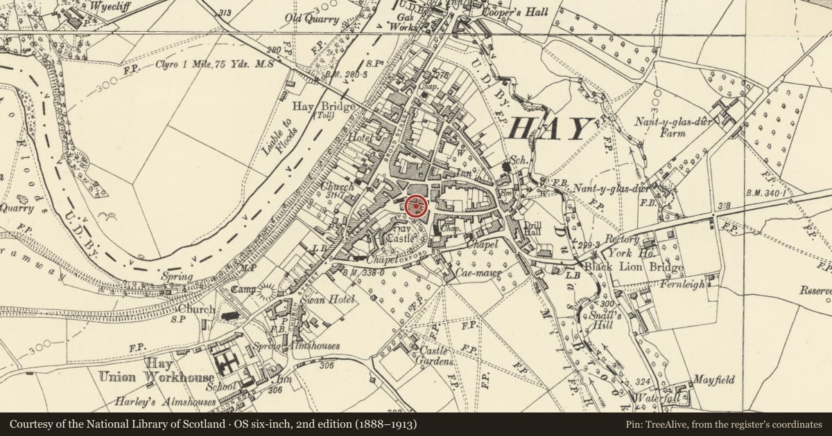
Slide toward Today to fade the historical sheet and see the modern map underneath.
David Rumsey Map Collection, Stanford LibrariesDavid Rumsey Map Collection, Stanford LibrariesDavid Rumsey Map Collection, Stanford LibrariesDavid Rumsey Map Collection, Stanford LibrariesDavid Rumsey Map Collection, Stanford Libraries
5 historical maps cover this location, the earliest the 1636 map "Cornubia : Devonia, Somersetus, Dorcestria, Wiltonia, Glocestria ..." (David Rumsey Map Collection, Stanford Libraries).
Historical maps covering this location
- 1636 · Cornubia : Devonia, Somersetus, Dorcestria, Wiltonia, Glocestria ... (David Rumsey Map Collection, Stanford Libraries)
- 1637 · Particular description of Wales. Cambria seu Wallia (David Rumsey Map Collection, Stanford Libraries)
- 1856 · 42. Brecon. (David Rumsey Map Collection, Stanford Libraries)
- 1898 · 197 Hay (Hills) (David Rumsey Map Collection, Stanford Libraries)
- 1901 · Sheet 14. (David Rumsey Map Collection, Stanford Libraries)
Cadw's description
Location
Forward to the street close to the Butter Market.
Exterior
Mid to late C18 front to structure with timber frame origins said to date back to 1641 and to be of upper cruck construction. Formerly jettied to 1st floor and with later addition of 2nd floor (cf. line of earlier wall head visible).
3-storey, broad 3-window scribed render front with rubble plinth to right.
Slate roof and boarded eaves. Forward to left is a squared projection rising to the original height of the building and possibly inserted to support the jetty. Small pane sash windows with flush frames and cills. Overall small fascia; shallow 5-light bay window to right, 6-panel part glazed door to centre and sash windows without glazing bars to left. Extension to rear.
Interior
The interior retains unmoulded beams, rubble fireplace to attic and open plan ground floor with cast iron columns.
Nearby in the register
- Hay Spinning GalleryCommercialunder 1 mi
- Butter MarketCommercialunder 1 mi
- Grove HouseCommercialunder 1 mi
- Pemberton'sCommercialunder 1 mi
Other entries of the same register within about three miles of this one, by straight line.