Cof Cymru: National Historic Assets of Wales · Wales
Fine Fare
Hay, Powys, Wales
A Grade II listed building in Hay, Powys, designated on 1 February 1988.
The record
- Designation
- Listed building, Grade II
- Broad class
- Commercial
- Date of designation
- 1 February 1988
- Community
- Hay
- Unitary authority
- Powys
- Country
- Wales
- Coordinates
- 52.07381, -3.12688
- Cadw reference
- 7339
Slide toward Today to fade the historical sheet and see the modern map underneath.
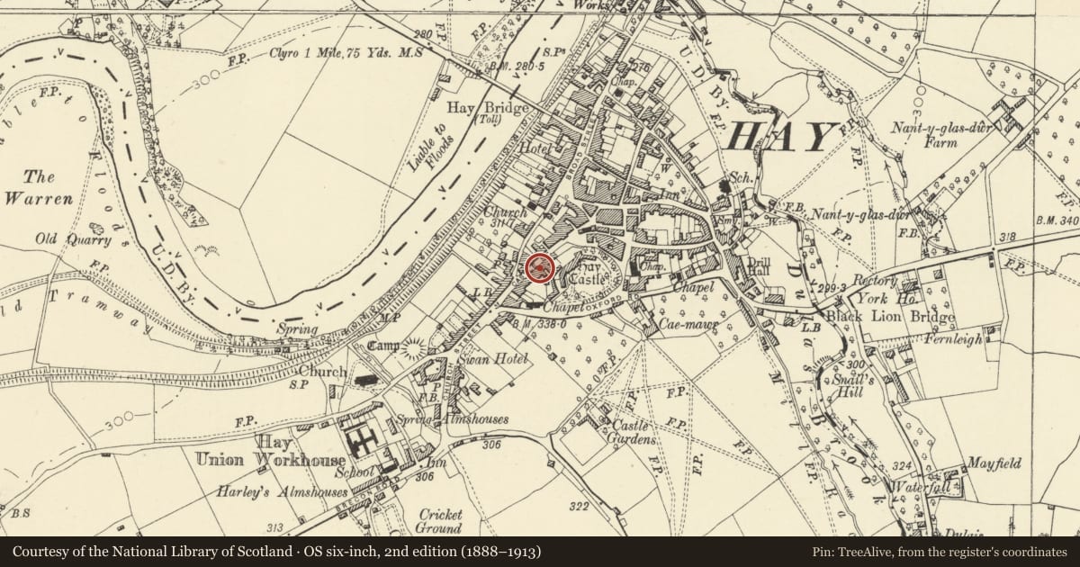
David Rumsey Map Collection, Stanford LibrariesDavid Rumsey Map Collection, Stanford LibrariesDavid Rumsey Map Collection, Stanford LibrariesDavid Rumsey Map Collection, Stanford LibrariesDavid Rumsey Map Collection, Stanford Libraries
5 historical maps cover this location, the earliest the 1636 map "Cornubia : Devonia, Somersetus, Dorcestria, Wiltonia, Glocestria ..." (David Rumsey Map Collection, Stanford Libraries).
Historical maps covering this location
- 1636 · Cornubia : Devonia, Somersetus, Dorcestria, Wiltonia, Glocestria ... (David Rumsey Map Collection, Stanford Libraries)
- 1637 · Particular description of Wales. Cambria seu Wallia (David Rumsey Map Collection, Stanford Libraries)
- 1856 · 42. Brecon. (David Rumsey Map Collection, Stanford Libraries)
- 1898 · 197 Hay (Hills) (David Rumsey Map Collection, Stanford Libraries)
- 1901 · Sheet 14. (David Rumsey Map Collection, Stanford Libraries)
Cadw's description
Location
Set back on the corner with Back Fold; No 27 adjoins forward to left. Formerly the Mason's Arms PH.
History
C17 origins, heightened and altered in C19.
Exterior
2-storey and attic, 2-window rendered front with high plinth. Slate roof and brick chimney stacks; swept roof dormer to centre. Recessed 12-pane sash windows to 1st floor; later sash glazing to splayed bays below with moulded cornices flanking off-centre modern door with bracket hood.
Whitewashed rubble right end with slightly battered base, set in the slope of back fold; the rear roof verge is steeper and slightly lower representing the original pitch. Cross range extends to rear slightly stepped out beyond casement and sash windows and then further back splayed out to depth of massive chimney breast with tall stone stack. Smaller brick stack at rear with slate roof lean-to beyond gable end of cross range which has projecting purlin ends.
Interior
One truss visible on 1st floor with moulded knee below the beam. Feather stop chamfer purlins to attic; boarded doors.
Reason for designation
Group value with neighbouring listed items in Castle Street.
Nearby in the register
- J.Geoffrey AspinCommercialunder 1 mi
- H.R.Grant including former Flannel mill to rearCommercialunder 1 mi
- Steve Davies Domestic AppliancesCommercialunder 1 mi
- Hay Cottage BakeryCommercialunder 1 mi
Other entries of the same register within about three miles of this one, by straight line.