Cof Cymru: National Historic Assets of Wales · Wales
14 Castle Street
Hay, Powys, Wales
A Grade II listed building in Hay, Powys, designated on 1 February 1988.
The record
- Designation
- Listed building, Grade II
- Broad class
- Domestic
- Date of designation
- 1 February 1988
- Community
- Hay
- Unitary authority
- Powys
- Country
- Wales
- Coordinates
- 52.07343, -3.12795
- Cadw reference
- 7334
Slide toward Today to fade the historical sheet and see the modern map underneath.
David Rumsey Map Collection, Stanford LibrariesDavid Rumsey Map Collection, Stanford LibrariesDavid Rumsey Map Collection, Stanford LibrariesDavid Rumsey Map Collection, Stanford LibrariesDavid Rumsey Map Collection, Stanford Libraries
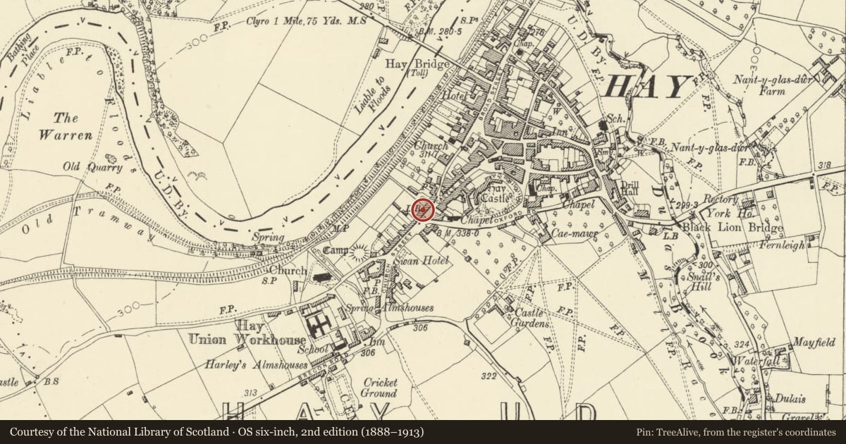
5 historical maps cover this location, the earliest the 1636 map "Cornubia : Devonia, Somersetus, Dorcestria, Wiltonia, Glocestria ..." (David Rumsey Map Collection, Stanford Libraries).
Historical maps covering this location
- 1636 · Cornubia : Devonia, Somersetus, Dorcestria, Wiltonia, Glocestria ... (David Rumsey Map Collection, Stanford Libraries)
- 1637 · Particular description of Wales. Cambria seu Wallia (David Rumsey Map Collection, Stanford Libraries)
- 1856 · 42. Brecon. (David Rumsey Map Collection, Stanford Libraries)
- 1898 · 197 Hay (Hills) (David Rumsey Map Collection, Stanford Libraries)
- 1901 · Sheet 14. (David Rumsey Map Collection, Stanford Libraries)
Cadw's description
Location
A short terrace, detached to left opposite the junction with Oxford Street.
History
C18 origins, later alterations.
Exterior
2-storey, 2-window mainly coursed rubble fronts, with central doorway. Proprietary slate roof; red brick chimney stack to No 14 (beside which the slightly higher cross range is visible) and rubble stack projecting at left end with brick cap. Small-pane windows mainly 12-pane sashes; splayed bay window to No 14 (Hairdresser's). Modern boarded doors. Fireman's helmet attached to the front of The Old Fire Station to right. Cross ranges and modern additions to rear.
Interior
The interior of No 14 retains stone flagged entrance hall and dog-leg staircase.
Reason for designation
Included for group value with the Blue Boar Inn, Radnor House and The Vicarage.
Nearby in the register
- The Old Fire StationCivilunder 1 mi
- 15 Castle StreetDomesticunder 1 mi
- Blue Boar Inn P.H.Commercialunder 1 mi
- DolycoedDomesticunder 1 mi
Other entries of the same register within about three miles of this one, by straight line.