Cof Cymru: National Historic Assets of Wales · Wales
19 Bear Street
Hay, Powys, Wales
A Grade II listed building in Hay, Powys, designated on 1 February 1988.
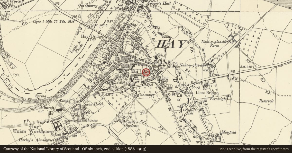
The record
- Designation
- Listed building, Grade II
- Broad class
- Domestic
- Date of designation
- 1 February 1988
- Community
- Hay
- Unitary authority
- Powys
- Country
- Wales
- Coordinates
- 52.07420, -3.12336
- Cadw reference
- 7278
Slide toward Today to fade the historical sheet and see the modern map underneath.
David Rumsey Map Collection, Stanford LibrariesDavid Rumsey Map Collection, Stanford LibrariesDavid Rumsey Map Collection, Stanford LibrariesDavid Rumsey Map Collection, Stanford LibrariesDavid Rumsey Map Collection, Stanford Libraries
5 historical maps cover this location, the earliest the 1636 map "Cornubia : Devonia, Somersetus, Dorcestria, Wiltonia, Glocestria ..." (David Rumsey Map Collection, Stanford Libraries).
Historical maps covering this location
- 1636 · Cornubia : Devonia, Somersetus, Dorcestria, Wiltonia, Glocestria ... (David Rumsey Map Collection, Stanford Libraries)
- 1637 · Particular description of Wales. Cambria seu Wallia (David Rumsey Map Collection, Stanford Libraries)
- 1856 · 42. Brecon. (David Rumsey Map Collection, Stanford Libraries)
- 1898 · 197 Hay (Hills) (David Rumsey Map Collection, Stanford Libraries)
- 1901 · Sheet 14. (David Rumsey Map Collection, Stanford Libraries)
Cadw's description
Location
Stepped down from Wellington House to left, set in the slope.
History
Earlier C19 shown on 1847 Tithe map.
Exterior
Pair of 3-storey, 1-window roughcast fronts; slate roof, brick chimney stack and plinth to No 18 including small-pane bay window to ground floor; modern 2nd floor window to No 19, horned 8-pane sash to 1st floor and altered bay window below. Half-glazed doors, lean-to hood to No 18, only one bracket remains of former hood to No 19.
Reason for designation
Included for group value with neighbouring listed items in Bear Street.
Nearby in the register
- MidstoneDomesticunder 1 mi
- Wellington HouseDomesticunder 1 mi
- Thornton HouseDomesticunder 1 mi
- HafodwenDomesticunder 1 mi
Other entries of the same register within about three miles of this one, by straight line.