Cof Cymru: National Historic Assets of Wales · Wales
Crickhowell Bridge
Crickhowell, Powys, Wales
A Grade I listed building in (partly in Llangattock community), Crickhowell, Powys, designated on 19 July 1963.
The record
- Designation
- Listed building, Grade I
- Broad class
- Transport
- Date of designation
- 19 July 1963
- Locality
- (partly in Llangattock community)
- Community
- Crickhowell
- Unitary authority
- Powys
- Country
- Wales
- Coordinates
- 51.85658, -3.14161
- Cadw reference
- 7237
Slide toward Today to fade the historical sheet and see the modern map underneath.
David Rumsey Map Collection, Stanford LibrariesDavid Rumsey Map Collection, Stanford LibrariesDavid Rumsey Map Collection, Stanford LibrariesDavid Rumsey Map Collection, Stanford LibrariesDavid Rumsey Map Collection, Stanford Libraries
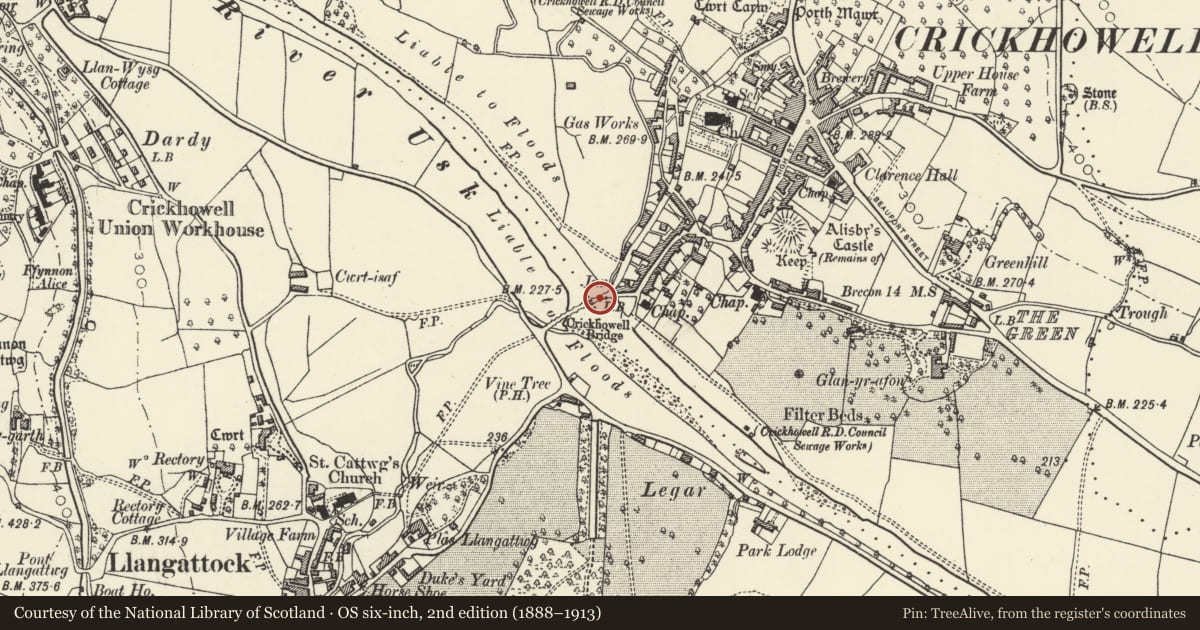
5 historical maps cover this location, the earliest the 1636 map "Cornubia : Devonia, Somersetus, Dorcestria, Wiltonia, Glocestria ..." (David Rumsey Map Collection, Stanford Libraries).
Historical maps covering this location
- 1636 · Cornubia : Devonia, Somersetus, Dorcestria, Wiltonia, Glocestria ... (David Rumsey Map Collection, Stanford Libraries)
- 1856 · 42. Brecon. (David Rumsey Map Collection, Stanford Libraries)
- 1898 · 232 Abergavenny (Hills) (David Rumsey Map Collection, Stanford Libraries)
- 1898 · 232 Abergavenny (Outline) (David Rumsey Map Collection, Stanford Libraries)
- 1901 · Sheet 14. (David Rumsey Map Collection, Stanford Libraries)
Cadw's description
Location
Situated to SW of and below the town, spanning the River Usk and partly in Llangattock Community Council.
History
Fine early road bridge rebuilt in 1706 and fequently repaired. First recorded in survey of 1538 and a map of 1760 shows it to have more arches, later alterations including widening in 1810 to NW side, having been criticized by Theophilus Jones for its narrowness; reconstuction to NE end when New Road was built in 1828 to 30 reduced the upsteam side by 1 arch.
Exterior
Single carriageway partly coursed rubble bridge; curved into the current. 13-arch to SE downstream side, 12-arch to NW upstream side; gently ramped towards centre. Low recessed segmental arches of varying widths with thin voussoirs and stringcourse to upstream side; V shaped cutwaters, plain cappings to parapets with refuges. Vertical joints and change to ashlar masonory indicate extent of widening. Low rubble abutment walls curve around corner to Llangattock road at SW end; rubble walls extend from NE end.
Scheduled Ancient Monument.
Reason for designation
A particularly special example of this building type.
Nearby in the register
- Bridgend InnCommercialunder 1 mi
- Crickhowell BridgeBridgeunder 1 mi
- Crickhowell Bridge (partly in Crickhowell community)Transportunder 1 mi
- Bethabara Baptist ChapelReligious, Ritual and Funeraryunder 1 mi
Other entries of the same register within about three miles of this one, by straight line.