Cof Cymru: National Historic Assets of Wales · Wales
Greenhill Villas
Crickhowell, Powys, Wales
A Grade II listed building in Crickhowell, Powys, designated on 25 September 1986.
The record
- Designation
- Listed building, Grade II
- Broad class
- Domestic
- Date of designation
- 25 September 1986
- Community
- Crickhowell
- Unitary authority
- Powys
- Country
- Wales
- Coordinates
- 51.85656, -3.13415
- Cadw reference
- 7194
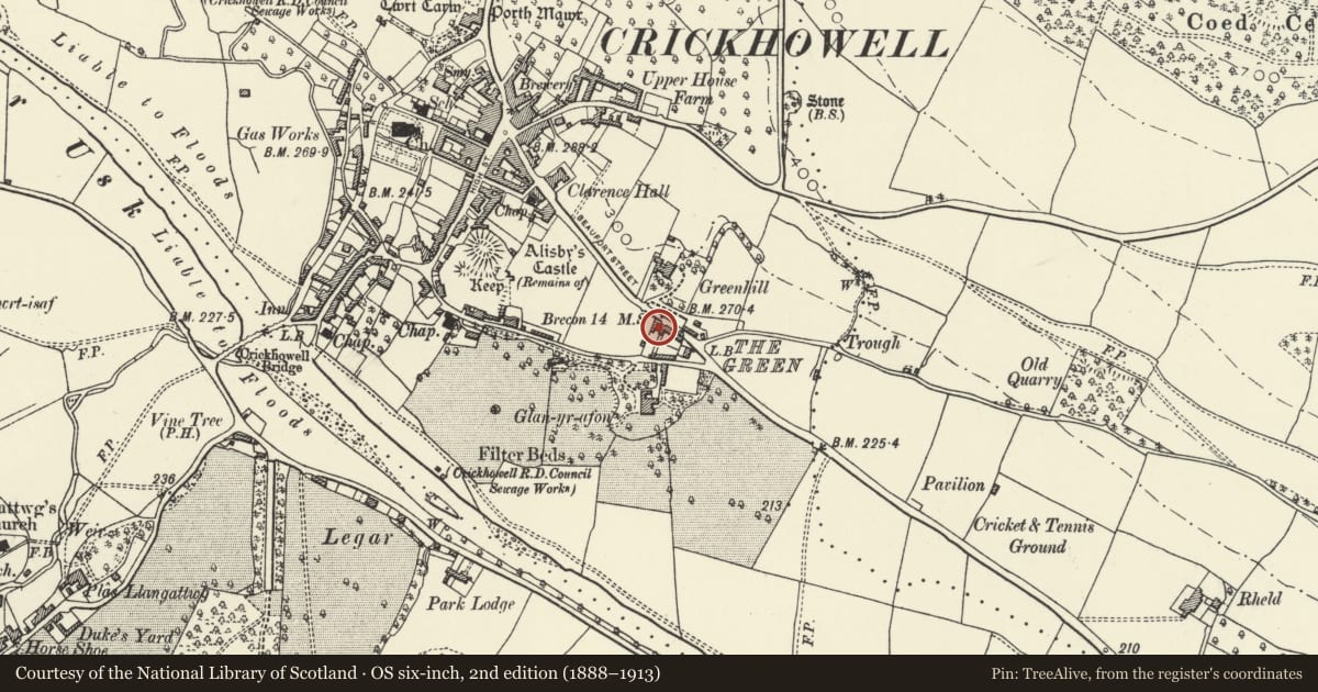
Slide toward Today to fade the historical sheet and see the modern map underneath.
David Rumsey Map Collection, Stanford LibrariesDavid Rumsey Map Collection, Stanford LibrariesDavid Rumsey Map Collection, Stanford LibrariesDavid Rumsey Map Collection, Stanford LibrariesDavid Rumsey Map Collection, Stanford Libraries
5 historical maps cover this location, the earliest the 1636 map "Cornubia : Devonia, Somersetus, Dorcestria, Wiltonia, Glocestria ..." (David Rumsey Map Collection, Stanford Libraries).
Historical maps covering this location
- 1636 · Cornubia : Devonia, Somersetus, Dorcestria, Wiltonia, Glocestria ... (David Rumsey Map Collection, Stanford Libraries)
- 1856 · 42. Brecon. (David Rumsey Map Collection, Stanford Libraries)
- 1898 · 232 Abergavenny (Hills) (David Rumsey Map Collection, Stanford Libraries)
- 1898 · 232 Abergavenny (Outline) (David Rumsey Map Collection, Stanford Libraries)
- 1901 · Sheet 14. (David Rumsey Map Collection, Stanford Libraries)
Cadw's description
Location
Situated on SE edge of the town beyond the Recreation Ground; No 1 set back behind iron-railed and rubble-walled front garden.
History
Pair of early C19 (shown on 1840 Tithe Map)
Exterior
Georgian fronts, possibly with earlier fabric to No 2, 3 storeys to No 1, 2 storeys to No 2; part coursed rubble to No 1, pebbledash to No 2. Slate roofs, narrow eaves, cement rendered rubble and brick chimney stacks, with weathercourses; proportion- ately large roof to No 2. Small-pane sash windows of various types, except to No 1 2nd floor; brick lintels to No 1 first floor and stone voussoir lintels to ground floor, all slightly cambered; 3-light sashes to No 2 1st floor and ground floor right with large 25-pane sash to left. Central open-pedimented doorcases to both, the former has been lowered; fluted pilasters to No 1, reeded to No 2. 6-panel doors and 4-pane fanlights.
Rubble end wall to No 1 with sash windows and lower lean-to range at rear.
Uneven rubble end wall to No 2 formerly with another building adjoining (shown in view of 1900).
Nearby in the register
- Greenhill VillasDomesticunder 1 mi
- Gazebo and adjoining rubble wall on Cwrt Newydd roadGardens, Parks and Urban Spacesunder 1 mi
- Gwar-y-CastellCommercialunder 1 mi
- National Westminster BankCommercialunder 1 mi
Other entries of the same register within about three miles of this one, by straight line.