Cof Cymru: National Historic Assets of Wales · Wales
Pont Rhyd-y-Cilgwyn
Llanynys, Denbighshire, Wales
A Grade II* listed building in Rhewl, Llanynys, Denbighshire, designated on 28 April 1952.
The record
- Designation
- Listed building, Grade II*
- Broad class
- Transport
- Date of designation
- 28 April 1952
- Locality
- Rhewl
- Community
- Llanynys
- Unitary authority
- Denbighshire
- Country
- Wales
- Coordinates
- 53.13314, -3.33403
- Cadw reference
- 718
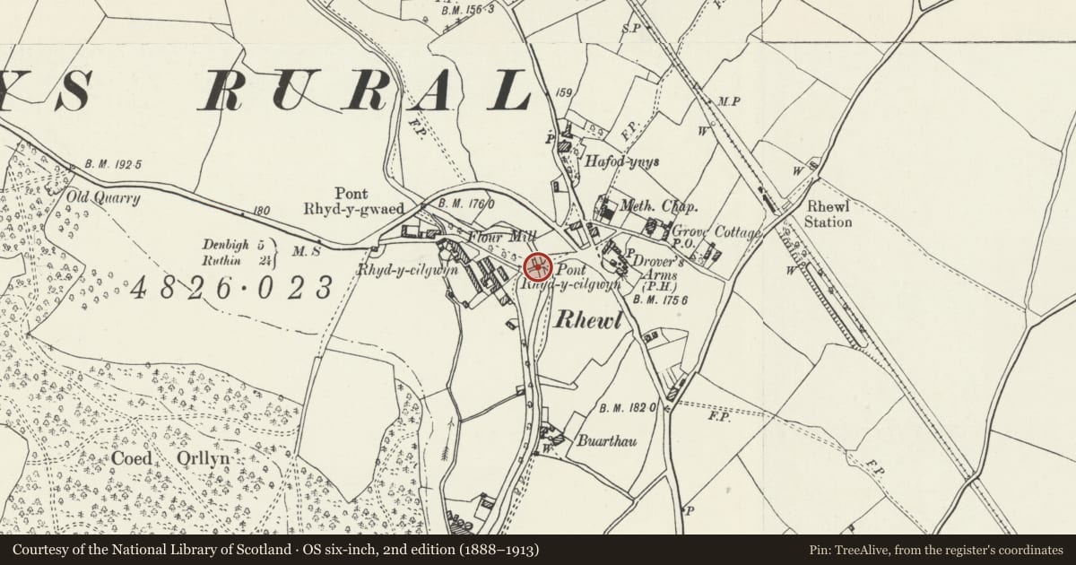
Slide toward Today to fade the historical sheet and see the modern map underneath.
David Rumsey Map Collection, Stanford LibrariesDavid Rumsey Map Collection, Stanford LibrariesLlyfrgell Genedlaethol Cymru – The National Library of WalesDavid Rumsey Map Collection, Stanford LibrariesDavid Rumsey Map Collection, Stanford Libraries
5 historical maps cover this location, the earliest the 1795 map "To Sir Watkin Williams-Wynn Bart ... the map of the six counties of North Wales is most humbly inscribed by his obedient humble servant" (Llyfrgell Genedlaethol Cymru – The National Library of Wales).
Historical maps covering this location
- 1795 · To Sir Watkin Williams-Wynn Bart ... the map of the six counties of North Wales is most… (Llyfrgell Genedlaethol Cymru – The National Library of Wales)
- 1830 · V.3:11-15:XV. Britisches Reich. A. Kon: England. b. Frstenthum Wales: Shire: 37-40 (David Rumsey Map Collection, Stanford Libraries)
- 1883 · Watershed map England, Wales 3. (David Rumsey Map Collection, Stanford Libraries)
- 1898 · 108 Flint (Hills) (David Rumsey Map Collection, Stanford Libraries)
- 1901 · Sheet 9 and 10. (David Rumsey Map Collection, Stanford Libraries)
Cadw's description
Location
Spanning the river Clywedog immediately W of the main road in the village centre.
History
Early 2-span road bridge, in its present form at least C17, and perhaps incorporating some of its predecessor (squared blocks of sandstone to its lower part).
Exterior
Long double-span road bridge of local limestone rubble construction, having squared blocks to its lower courses. Segmental arches with rough-dressed voussoirs recessed in two tiers below arch-rings of narrow stones. Central triangular cutwater to both sides, that to the upriver side incorporating a moulded sandstone plinth base surmounted by the stump of a sandstone shaft or column. Gently-humped carriageway with low, uncoped rubble parapets splayed-out at the approaches and extending in long stretches to either side.
Reason for designation
Listed Grade II* for its special interest as a fine C17 2-span bridge in a prominent location within an attractive village setting.
Nearby in the register
- Agricultural Complex at Rhyd-y-CilgwynAgriculture and Subsistenceunder 1 mi
- Former Stable and Carthouse Range at Rhyd-y-CilgwynAgriculture and Subsistenceunder 1 mi
- Rhyd-y-CilgwynDomesticunder 1 mi
- Rhewl Chapel and ManseReligious, Ritual and Funeraryunder 1 mi
Other entries of the same register within about three miles of this one, by straight line.