Cof Cymru: National Historic Assets of Wales · Wales
90 The Watton
Brecon, Powys, Wales
A Grade II listed building in Brecon, Powys, designated on 16 December 1976.
The record
- Designation
- Listed building, Grade II
- Broad class
- Domestic
- Date of designation
- 16 December 1976
- Town
- Brecon
- Community
- Brecon
- Unitary authority
- Powys
- Country
- Wales
- Coordinates
- 51.94380, -3.38375
- Cadw reference
- 7138
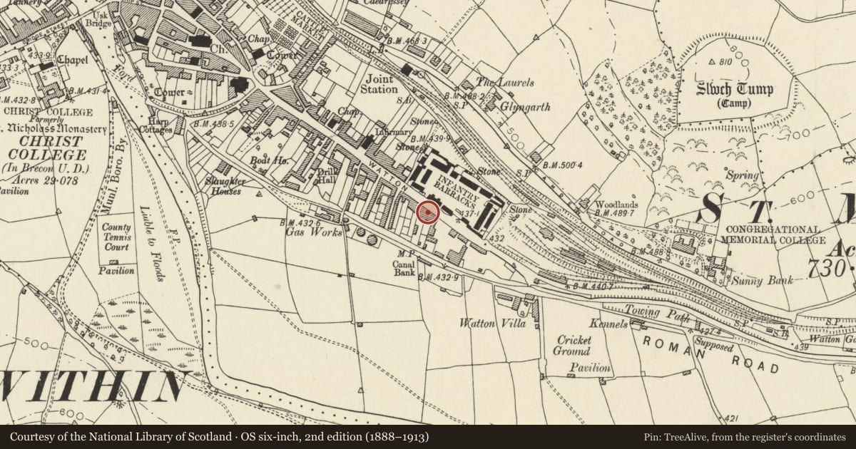
Slide toward Today to fade the historical sheet and see the modern map underneath.
David Rumsey Map Collection, Stanford LibrariesDavid Rumsey Map Collection, Stanford LibrariesDavid Rumsey Map Collection, Stanford LibrariesDavid Rumsey Map Collection, Stanford LibrariesDavid Rumsey Map Collection, Stanford Libraries
5 historical maps cover this location, the earliest the 1608 map "(13) Cambriae Typus." (David Rumsey Map Collection, Stanford Libraries).
Historical maps covering this location
- 1608 · (13) Cambriae Typus. (David Rumsey Map Collection, Stanford Libraries)
- 1636 · Cornubia : Devonia, Somersetus, Dorcestria, Wiltonia, Glocestria ... (David Rumsey Map Collection, Stanford Libraries)
- 1856 · 42. Brecon. (David Rumsey Map Collection, Stanford Libraries)
- 1898 · 213 Brecon (Hills) (David Rumsey Map Collection, Stanford Libraries)
- 1901 · Sheet 14. (David Rumsey Map Collection, Stanford Libraries)
Cadw's description
Location
Opposite The Barracks.
History
Circa mid C19.
Exterior
No.90: stuccoed front; plinth. Three sash windows without glazing bars on first floor. On ground floor, two C19 shop windows and a doorway each with framework of pilasters and cornice on consoles.
Reason for designation
Early C19 row retaining much character. Group value with adjacent listed buildings in The Watton.
Nearby in the register
- 89 The WattonDomesticunder 1 mi
- 91 The WattonNo class recordedunder 1 mi
- 92 The WattonNo class recordedunder 1 mi
- 88 The WattonDomesticunder 1 mi
Other entries of the same register within about three miles of this one, by straight line.