Cof Cymru: National Historic Assets of Wales · Wales
The Puzzle Tree Restaurant, including Stone Wall and Railings
Brecon, Powys, Wales
A Grade II listed building in Brecon, Powys, designated on 16 December 1976.
The record
- Designation
- Listed building, Grade II
- Broad class
- Commercial
- Date of designation
- 16 December 1976
- Town
- Brecon
- Community
- Brecon
- Unitary authority
- Powys
- Country
- Wales
- Coordinates
- 51.94604, -3.38885
- Cadw reference
- 7118
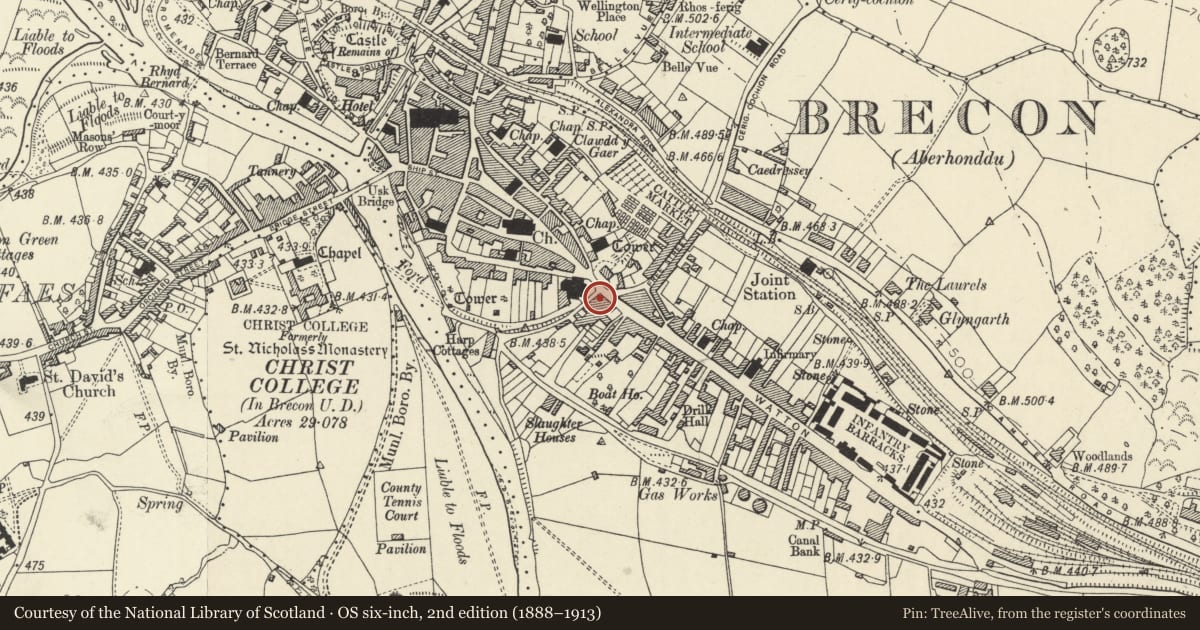
Slide toward Today to fade the historical sheet and see the modern map underneath.
David Rumsey Map Collection, Stanford LibrariesDavid Rumsey Map Collection, Stanford LibrariesDavid Rumsey Map Collection, Stanford LibrariesDavid Rumsey Map Collection, Stanford LibrariesDavid Rumsey Map Collection, Stanford Libraries
5 historical maps cover this location, the earliest the 1608 map "(13) Cambriae Typus." (David Rumsey Map Collection, Stanford Libraries).
Historical maps covering this location
- 1608 · (13) Cambriae Typus. (David Rumsey Map Collection, Stanford Libraries)
- 1636 · Cornubia : Devonia, Somersetus, Dorcestria, Wiltonia, Glocestria ... (David Rumsey Map Collection, Stanford Libraries)
- 1856 · 42. Brecon. (David Rumsey Map Collection, Stanford Libraries)
- 1898 · 213 Brecon (Hills) (David Rumsey Map Collection, Stanford Libraries)
- 1901 · Sheet 14. (David Rumsey Map Collection, Stanford Libraries)
Cadw's description
Location
Opposite Brecknock Museum, on corner with Danygaer Road.
History
Earlier C19, probably roughly contemporary with Museum on opposite side of Danygaer Road. Built as town house for local business man who payed for relocation of Brecon Gaol from here to its later site. remodelled as a bank, and still bears plaque with inscription "West Midland Savings Bank Salop, West Midland and Welsh Counties Savings Bank Brecon Branch". Became Trustee Savings Bank; converted to restaurant use late C20.
Exterior
Former Bank, now restaurant. Stucco on grey rusticated stone plinth; two storeys and cellar. Two wings with slate hipped roofs at right angles to each other; convex bay between return elevations on corner. Band at first floor sill level. generally 12-pane sash windows. Elevation to The Watton of two bays. First floor window openings with moulded architraves; ground floor window openings with friezes and cornices and panelled aprons. Elevation to Danygaer Road of three bays; ground floor windows in end bays are tripartite sash windows with stuccoed pilasters between lights and with cornices and triangular pediments over centre light. Centre window with frieze and cornice over. Convex corner bay is recessed with doorway behind convex Roman Doric porch. Watton elevation recessed behind a small enclosure bounded by a stone wall and iron railings which extend as far as No.37 The Watton.
Interior
Converted to pub restaurant. Small octagonal vestibule with moulded cornice.
Reason for designation
Well-designed and preserved early-to-mid C19 bank building. Group Value with adjacent listed buildings in the Watton.
Nearby in the register
- 37 The WattonCommercialunder 1 mi
- Forecourt Walls & Railings to the Brecknock MuseumDomesticunder 1 mi
- Pillar Box in Forecourt of Brecknock MuseumCommunicationsunder 1 mi
- Shop, including former Theatre to rearCommercialunder 1 mi
Other entries of the same register within about three miles of this one, by straight line.