Cof Cymru: National Historic Assets of Wales · Wales
Outbuildings to NE of Gwerclas Hall
Cynwyd, Denbighshire, Wales
A Grade II listed building in Gwerclas, Cynwyd, Denbighshire, designated on 20 October 1966.
The record
- Designation
- Listed building, Grade II
- Broad class
- Domestic
- Date of designation
- 20 October 1966
- Locality
- Gwerclas
- Community
- Cynwyd
- Unitary authority
- Denbighshire
- Country
- Wales
- Coordinates
- 52.96834, -3.41115
- Cadw reference
- 709
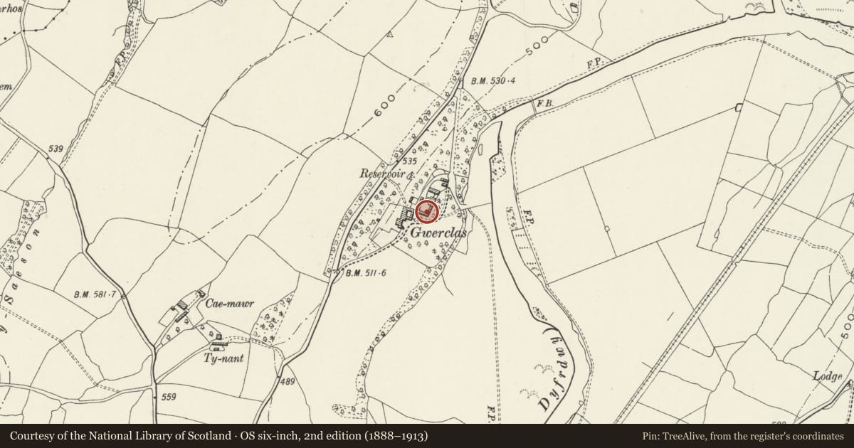
Slide toward Today to fade the historical sheet and see the modern map underneath.
David Rumsey Map Collection, Stanford LibrariesDavid Rumsey Map Collection, Stanford LibrariesLlyfrgell Genedlaethol Cymru – The National Library of WalesDavid Rumsey Map Collection, Stanford LibrariesDavid Rumsey Map Collection, Stanford Libraries
5 historical maps cover this location, the earliest the 1795 map "To Sir Watkin Williams-Wynn Bart ... the map of the six counties of North Wales is most humbly inscribed by his obedient humble servant" (Llyfrgell Genedlaethol Cymru – The National Library of Wales).
Historical maps covering this location
- 1795 · To Sir Watkin Williams-Wynn Bart ... the map of the six counties of North Wales is most… (Llyfrgell Genedlaethol Cymru – The National Library of Wales)
- 1830 · V.3:11-15:XV. Britisches Reich. A. Kon: England. b. Frstenthum Wales: Shire: 37-40 (David Rumsey Map Collection, Stanford Libraries)
- 1883 · Watershed map England, Wales 3. (David Rumsey Map Collection, Stanford Libraries)
- 1898 · 120 Corwen (Hills) (David Rumsey Map Collection, Stanford Libraries)
- 1901 · Sheet 9 and 10. (David Rumsey Map Collection, Stanford Libraries)
Cadw's description
Location
Located to the NE of Gwerclas Hall and associated courtyard buildings.
History
The layout of the buildings is shown on the tithe map of 1838. Substantial alterations occurred in the early C20 when the complex was converted to a dairy.
Exterior
The buildings are arranged around 4 sides of a courtyard, and some are in poor condition. Mainly of random stone with slate roofs; wooden door and window frames, much of the glazing and doors missing.
The lofted W range, facing E into courtyard, has a doorway to R of centre and window opening to L of centre, with loft opening above (no glazing or doors). Further L, the range is ruined, with a scar of the S gable end visible on the S range. N gable end has been truncated, the wall replaced by corrugated iron sheeting with a pair of openings to ground floor and one to loft. No openings to external W side.
The N range was originally a barn. It is of rubble stone with a corrugated asbestos roof. The S side, facing into the yard has a wide full-height central opening, later infilled with masonry to the L-hand side and some brickwork to the R. Inserted into the former is a cast iron bearing box which carried a shaft to the inside of the building, probably from a stationary engine. To the L is a hole in the wall, infilled with brick and a former window opening; ventilation slits to far L. The W gable end has a wide opening offset to L; large circular vents to both gables. Two high-level openings to N wall.
To the E of the courtyard is an external boundary wall, against which are 2 single-storey animal houses; that to L is small with a doorway to L, the roof partly missing. Second building to R is of dressed masonry, and has doorway to L, with unglazed overlight, and window to R with segmental brick head. Also doorway to L-return. Wide opening to far R.
Long S range with doorways to L and centre of courtyard side, the latter with brick jambs and a concrete lintel. Part-glazed wooden window with ventilator between doorways. Long C20 window to far R in brick infill to former opening. Loft with raked dormer to L of centre, no hatch. The W gable end has a loft hatch with timber slats. S external side has C20 openings; from L, C20 garage doors, C20 door with brick jambs, C20 wooden window; planked door with brick jambs, and 4-pane window to R. Loft hatch above
Interior
The W range was used as a milking shed in the C20, with the remains of metal stall partitions, a manger against the W wall and concrete floors. The ceiling has 3 cross beams, slightly chamfered, and plain joists to the loft floor, which is reached by a wooden ladder immediately R of the entrance.
North range has 5-bay interior open to the roof; tie beam trusses, mainly nailed, with curved struts. Remains of metal-framed stall partitions and concrete floors. On the internal N wall is a cast iron bearing box, aligned with that outside.
Reason for designation
Listed for group value with Gwerclas Hall and associated courtyard buildings.
Nearby in the register
- Oubuildings adjoining N side of Gwerclas HallDomesticunder 1 mi
- Gwerclas HallDomesticunder 1 mi
- Gwerclas MoundMoundunder 1 mi
- Summerhouse, Garden Wall and attached privy at Gwerclas HallRecreationalunder 1 mi
Other entries of the same register within about three miles of this one, by straight line.