Cof Cymru: National Historic Assets of Wales · Wales
Bull's Head Hotel
Brecon, Powys, Wales
A Grade II listed building in Brecon, Powys, designated on 31 May 1961.
The record
- Designation
- Listed building, Grade II
- Broad class
- Commercial
- Date of designation
- 31 May 1961
- Town
- Brecon
- Community
- Brecon
- Unitary authority
- Powys
- Country
- Wales
- Coordinates
- 51.95022, -3.39097
- Cadw reference
- 7065
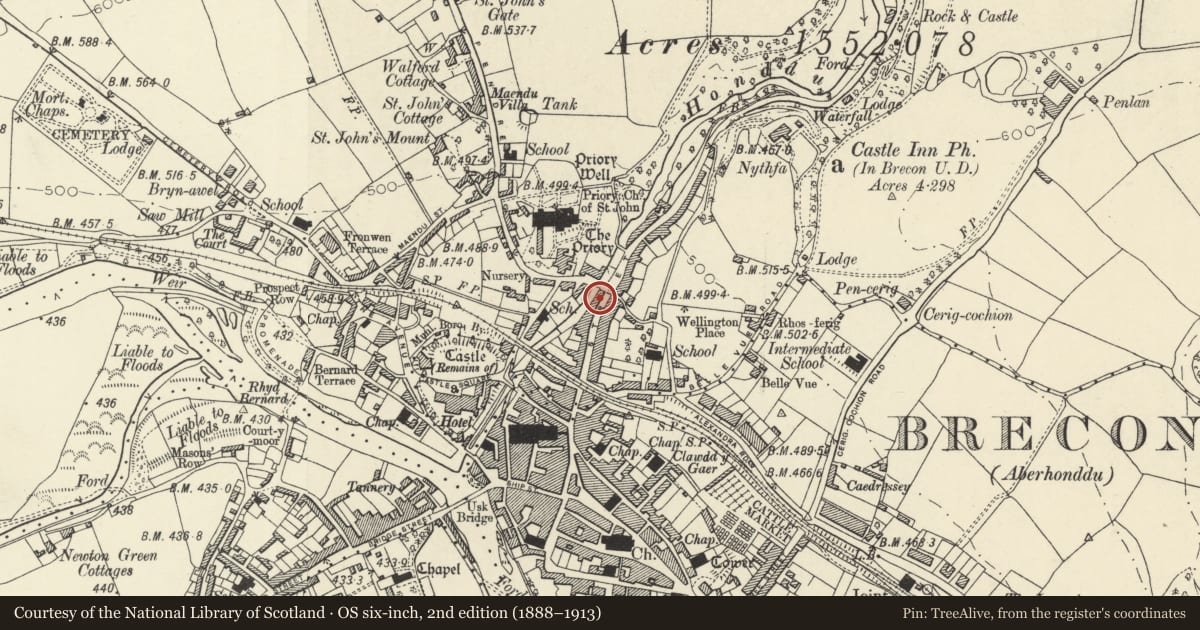
Slide toward Today to fade the historical sheet and see the modern map underneath.
David Rumsey Map Collection, Stanford LibrariesDavid Rumsey Map Collection, Stanford LibrariesDavid Rumsey Map Collection, Stanford LibrariesDavid Rumsey Map Collection, Stanford LibrariesDavid Rumsey Map Collection, Stanford Libraries
5 historical maps cover this location, the earliest the 1608 map "(13) Cambriae Typus." (David Rumsey Map Collection, Stanford Libraries).
Historical maps covering this location
- 1608 · (13) Cambriae Typus. (David Rumsey Map Collection, Stanford Libraries)
- 1636 · Cornubia : Devonia, Somersetus, Dorcestria, Wiltonia, Glocestria ... (David Rumsey Map Collection, Stanford Libraries)
- 1856 · 42. Brecon. (David Rumsey Map Collection, Stanford Libraries)
- 1898 · 213 Brecon (Hills) (David Rumsey Map Collection, Stanford Libraries)
- 1901 · Sheet 14. (David Rumsey Map Collection, Stanford Libraries)
Cadw's description
Location
To S of Priory Bridge.
History
Probably early C19. Important corner building on Priory Hill by Priory Bridge see watercolour of The Struet by J M Ince, date 1850 and in National Library of Wales.
Exterior
Public house. Three storeys. Slate roof, hipped to N. Roughcast render with stuccoed architraves.
Elevation to The Struet of three bays; northernmost bay with 16-pane sash window on ground floor only. The two other bays with similar sash windows on both second and first floors; on ground floor, a 16-pane sash window in left hand bay and, in middle bay, round-headed and pedimented doorway with six-panelled door and semi-circular fanlight with radiating tracery. Narrow windowless splayed bay on corner. North end elevation of two windows; sash windows four panes wide on second floor and five panes wide on first floor; two sash windows without glazing bars on ground floor. To rear, overlooking River Honddu, a tall stair window to both second and first floor; small-pane sash windows. A further sash window to both second and first floor. On ground floor, a lean-to overhanging the River.
Interior
The public areas have been modernised.
Reason for designation
Public house retaining much characater on important site backing onto River Honddu. Group Value with adjacent listed bridge and attached buildings to S.
Nearby in the register
- 87 The StruetCommercialunder 1 mi
- 88 The StruetNo class recordedunder 1 mi
- 89 The StruetNo class recordedunder 1 mi
- Priory BridgeTransportunder 1 mi
Other entries of the same register within about three miles of this one, by straight line.