Cof Cymru: National Historic Assets of Wales · Wales
66/67 The Struet, including Forecourt Wall & Railings
Brecon, Powys, Wales
A Grade II listed building in Brecon, Powys, designated on 16 December 1976.
The record
- Designation
- Listed building, Grade II
- Broad class
- Domestic
- Date of designation
- 16 December 1976
- Town
- Brecon
- Community
- Brecon
- Unitary authority
- Powys
- Country
- Wales
- Coordinates
- 51.95174, -3.38886
- Cadw reference
- 7060
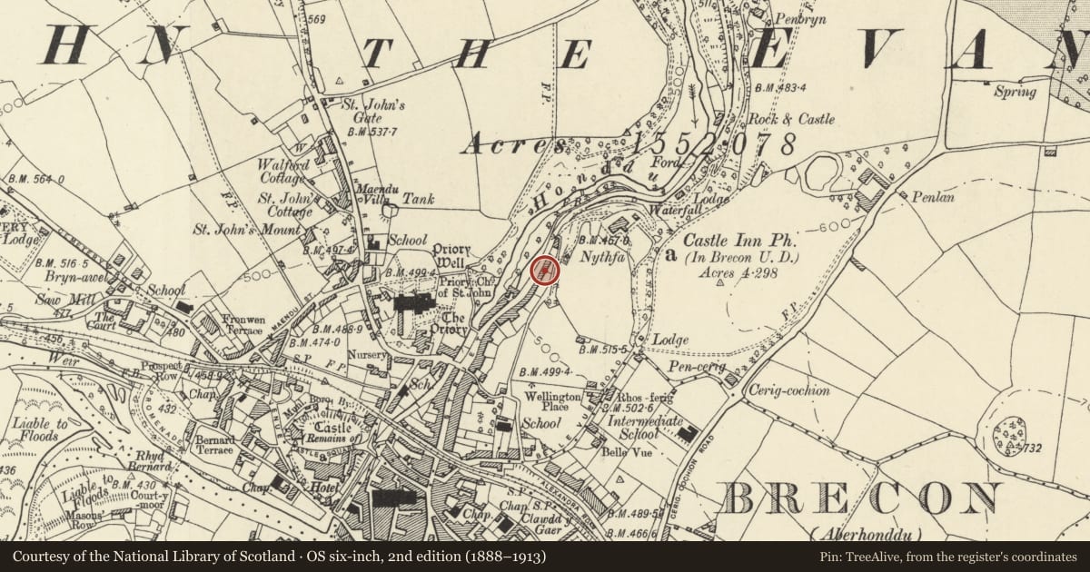
Slide toward Today to fade the historical sheet and see the modern map underneath.
David Rumsey Map Collection, Stanford LibrariesDavid Rumsey Map Collection, Stanford LibrariesDavid Rumsey Map Collection, Stanford LibrariesDavid Rumsey Map Collection, Stanford LibrariesDavid Rumsey Map Collection, Stanford Libraries
5 historical maps cover this location, the earliest the 1608 map "(13) Cambriae Typus." (David Rumsey Map Collection, Stanford Libraries).
Historical maps covering this location
- 1608 · (13) Cambriae Typus. (David Rumsey Map Collection, Stanford Libraries)
- 1636 · Cornubia : Devonia, Somersetus, Dorcestria, Wiltonia, Glocestria ... (David Rumsey Map Collection, Stanford Libraries)
- 1856 · 42. Brecon. (David Rumsey Map Collection, Stanford Libraries)
- 1898 · 213 Brecon (Hills) (David Rumsey Map Collection, Stanford Libraries)
- 1901 · Sheet 14. (David Rumsey Map Collection, Stanford Libraries)
Cadw's description
Location
Towards N end of built-up part of The Struet; opposite open land and River Honddu.
History
Formerly three C19 cottages of one window bay and door each; Nos.66 and 67 are now one.
Exterior
Belongs to a group of 66,67 & 68 The Struet, including Front Forecourt Wall and Railings.
No.66/67 has two 12-pane sash windows on each floor, and shares a blind first floor window with No.68; doorway to R, panelled door, shallow overlight.
The houses are set above street level and behind a narrow forecourt which is enclosed by a stone retaining wall and C19 iron railings with narrow uprights and fleur-de-lys finials.
Reason for designation
Good group of earlier C19 houses with Group Value with adjacent listed buildings inThe Struet.
Nearby in the register
- 68 The Struet, including Forecourt Wall & RailingsNo class recordedunder 1 mi
- 72 The StruetDomesticunder 1 mi
- 73 The StruetNo class recordedunder 1 mi
- 47 The StruetDomesticunder 1 mi
Other entries of the same register within about three miles of this one, by straight line.