Cof Cymru: National Historic Assets of Wales · Wales
Rutland House, including Forecourt Wall, Piers & Iron Railings
Brecon, Powys, Wales
A Grade II* listed building in Brecon, Powys, designated on 16 January 1952.
The record
- Designation
- Listed building, Grade II*
- Broad class
- Domestic
- Date of designation
- 16 January 1952
- Town
- Brecon
- Community
- Brecon
- Unitary authority
- Powys
- Country
- Wales
- Coordinates
- 51.94941, -3.39104
- Cadw reference
- 7041
Slide toward Today to fade the historical sheet and see the modern map underneath.
David Rumsey Map Collection, Stanford LibrariesDavid Rumsey Map Collection, Stanford LibrariesDavid Rumsey Map Collection, Stanford LibrariesDavid Rumsey Map Collection, Stanford LibrariesDavid Rumsey Map Collection, Stanford Libraries
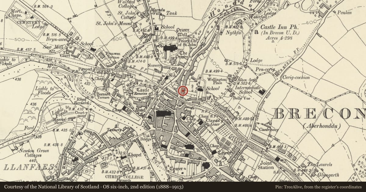
5 historical maps cover this location, the earliest the 1608 map "(13) Cambriae Typus." (David Rumsey Map Collection, Stanford Libraries).
Historical maps covering this location
- 1608 · (13) Cambriae Typus. (David Rumsey Map Collection, Stanford Libraries)
- 1636 · Cornubia : Devonia, Somersetus, Dorcestria, Wiltonia, Glocestria ... (David Rumsey Map Collection, Stanford Libraries)
- 1856 · 42. Brecon. (David Rumsey Map Collection, Stanford Libraries)
- 1898 · 213 Brecon (Hills) (David Rumsey Map Collection, Stanford Libraries)
- 1901 · Sheet 14. (David Rumsey Map Collection, Stanford Libraries)
Cadw's description
Location
About 30 metres N of junction with Mount Street.
History
C18. Nos 9 and 10 were once joined together and were built by Hugh Bold, Attorney. Formerly Lloget House. Converted to flats late C20.
Exterior
Gentry house of three storeys over basement. Five window front, roughcast. Slate roof with rendered flanking stacks. Overhanging eaves with paired brackets to soffit and panelled eaves band. Top storey has square 6-pane hornless sash windows; other windows 12-pane hornless sashes. Central Doric doorcase with pilasters, entablature with triglyphs and triangular pediment with modillions approached by a flight of steps. Part-glazed double panelled doors.
Forecourt enclosed by wall and railings. Dwarf stone wall with ashlar coping; railings with uprights with arrowhead finials; stone gate piers with capping; iron gates. There is, to L, simple gateway to basement entrance.
Garden to rear with brick terracing.
Interior
Converted to flats. Lobby with cornice, dado, panelled doors. Staircase (early C18?) with turned balusters. Retains much period detail including cornices, contemporary doorcases and panelled doors. Adamesque fireplace; fireplace to former kitchen to rear.
Reason for designation
Graded II* as fine late C18 town house with surviving interiors. Group Value with adjacent listed buildings.
Nearby in the register
- Post Box outside No.8 The StruetCommercialunder 1 mi
- 8 The StruetCommercialunder 1 mi
- The ElmsDomesticunder 1 mi
- Telephone Call-box outside No.10 The StruetCommunicationsunder 1 mi
Other entries of the same register within about three miles of this one, by straight line.